The wooden bridge of Flam in Norway

Il ponte in legno di Flam in Norvegia

The Flam Wooden Bridge in Norway.
Nestled in the majestic mountains of Norway, the picturesque village of Flam is famous not only for its breathtaking scenery but also for its charming wooden bridge. This bridge, which spans the Flam River, has become a local icon, a symbol of the connection between man and nature.
The Flam Wooden Bridge, with its elegant and rustic architecture, blends in perfectly with its surroundings. Its solid wooden beams rise towards the sky, while the interwoven railings create an artistic effect that captures the attention of anyone who passes over it. The choice of wood as the main material is not only aesthetically pleasing, but also a tribute to the Norwegian building tradition, which has made wise use of natural resources for centuries.
In addition to its visual beauty, the Flam Bridge plays a fundamental role in the life of the local community. By connecting the two banks of the river, it facilitates the daily transit of residents and visitors, creating a tangible connection between people and the surrounding nature. The feeling of walking on this bridge is a unique experience, allowing visitors to fully immerse themselves in the natural beauty of Norway.
During the warmer seasons, the bridge becomes a meeting point for locals and tourists, offering a scenic space to admire the surrounding landscape. During the winter, however, the bridge takes on a different charm, with snow gently settling on the wooden beams, creating an enchanting picture.
The construction of the Flam wooden bridge is also an example of ecological engineering, with the aim of minimising the impact on the surrounding environment. The architects have cleverly integrated the bridge into the natural topography, avoiding disturbances and preserving the beauty of the place.

In conclusion, the Flam wooden bridge is much more than a simple crossing structure. It is a symbol of connection, union and respect for the environment. Crossing this bridge, you can experience a moment of quiet and contemplation, surrounded by the pristine beauty of Norway and the warmth of a community that values ​​its history and its natural environment.

Do you know Norway?
Add your own comment or go to the bottom of the site to read what other visitors have written.

Il ponte in legno di Flam in Norvegia

Il ponte in legno di Flam in Norvegia

Il ponte in legno di Flam in Norvegia

Photo taken with Canon EOS RP and lens Tamron 16-300.

To see all the photos of little Flam click here:

Here's where the bridge is located:

Flåm is a Norwegian village of about 500 inhabitants, at the end of the Aurlandsfjord, a branch of the Sognefjord. The village is located in the municipality of Aurland, in the county of Vestland, Norway. It is touched by the European route E16. The valley of Flåm was formed by the thick layer of ice that remained in this area for millions of years: the erosion of the glacier made the land sink, creating the deep and wide valleys that attract a large number of tourists every year.
Continue and learn more on Wikipedia

The Flam wooden bridge in Norway – Le pont en bois de Flam en Norvège – El puente de madera de Flam en Noruega – A ponte de madeira Flam na Noruega – Die Flam-Holzbrücke in Norwegen – Cây cầu gỗ Flam ở Na Uy – 挪威弗洛姆木桥 – ノルウェーのフロムの木の橋

The text of the post was written with the help of ChatGPT, a language model from OpenAI.

The view of the Geirangerfjord from the ship

La vista del fiordo di Geiranger dalla nave

The view of the Geirangerfjord from the ship.
Travelling by ship (I was on the Costa Firenze) along the famous Geirengerfjord you can admire a spectacle of nature that is still almost uncontaminated.

Have you ever been on a cruise in the Norwegian fjords? Add your own comment or go to the bottom of the site to read what other visitors have written.

Photo taken with Canon EOS RP and lens Tamron 16-300.

To see all the other photos, click here:
foto gallery

Here's where the fjord is located:

The Geirangerfjord (Geirangerfjorden) is a fjord in the Norwegian region of Sunnmøre in the south of the county of Møre og Romsdal. It is a branch of the much larger Storfjorden and within it is the famous village of Geiranger. The fjord is one of the most visited natural sites in Norway and since 2005 it is included, together with the Nærøyfjord, in the List of World Heritage Sites drawn up by UNESCO. The presence of these two fjords in the list is however threatened by a plan to build some power lines through the fjord.
Continue and learn more on Wikipedia

The view of the Geiranger Fjord from the ship – La vue sur le fjord de Geiranger depuis le navire – La vista del fiordo de Geiranger desde el barco. – A vista do fiorde de Geiranger do navio – Der Blick auf den Geiranger Fjord vom Schiff aus – Quang cảnh Geiranger Fjord từ tàu – 从船上看盖朗厄尔峡湾的景色 – 船からのガイランゲルフィヨルドの眺め

Dream sea: the transparent waters of Framura

Mare da sogno: le acque trasparenti di Framura

Dream sea: the transparent waters of Framura
One of the places in my area (Eastern Liguria) that I like to go to in the summer to have a nice swim is Framura.
The tiny village near the Cinque Terre has a splendid promenade, overlooking the sea, along which you can reach a couple of truly enchanting beaches.
And if you are an adventure lover, here and there along the promenade, there are points where you can go down to the sea and dive into this truly crystalline water!

Do you know Framura? Add a comment or go to the bottom of the site to read what other visitors have written.

Mare da sogno: le acque trasparenti di Framura

Photo taken with Honor 20.

Here's where the walk is located:

Situated on the Ligurian coast, the small town of Framura is located within one of the many inlets and coves, typical of the rugged coast of the eastern Ligurian Riviera. Mount Serro (421 m. above sea level) is the highest peak in the Framura area and belongs to the protected area of ​​the Cinque Terre.
Continue on Wikipedia

Dream sea: the transparent waters of Framura – Mer de rêve : les eaux transparentes de Framura – Mar de ensueño: las aguas transparentes de Framura – Mar dos sonhos: as águas transparentes de Framura – Traummeer: ​​das transparente Wasser von Framura – Biển mộng mơ: làn nước trong suốt của Framura – 梦幻之海:Framura 透明的海水 – 夢の海:フラムーラの透明な海

Alcune cascate ammirate nel Geirangerfjord

Alcune cascate ammirate navigando attraverso il Geirangerfjord

Alcune cascate ammirate navigando attraverso il Geirangerfjord.
Lo scorso anno ho navigato, un paio di mesi, effettuando le crociere nei fiordi norvegesi. Forse quello più famoso è quello di Geiranger e le sue cascate.
Il Geirangerfjord è un fiordo situato nella regione occidentale della Norvegia, famoso per la sua bellezza mozzafiato e il suo paesaggio naturale spettacolare. È stato incluso nell’elenco dei Patrimoni dell’Umanità dell’UNESCO nel 2005, riconoscendo la sua importanza ecologica e paesaggistica.

Ecco alcune caratteristiche distintive del Geirangerfjord:
1. Paesaggio Incredibile: Il Geirangerfjord è circondato da ripide montagne, pareti rocciose e picchi imponenti che si ergono verticalmente dalle acque del fiordo. Questo paesaggio crea uno spettacolo visivo straordinario, con cascate spettacolari, valli verdi e piccoli villaggi che punteggiano la costa.
2. Sette Sorelle e Il Velo della Sposa: Le Sette Sorelle e il Velo della Sposa sono alcune delle cascate più famose del Geirangerfjord. Le Sette Sorelle sono sette cascate separate che scendono dalle montagne e il Velo della Sposa è una cascata sottile che sembra un velo sospeso lungo una parete rocciosa.
3. Crociere Fjord: Una delle migliori maniere per esplorare il Geirangerfjord è attraverso crociere in barca che offrono una prospettiva unica delle sue spettacolari formazioni rocciose e cascate. Durante la crociera, i visitatori possono godere di viste panoramiche e scoprire la ricca flora e fauna della regione.
4. Dalsnibba: Il punto di vista di Dalsnibba offre una vista mozzafiato sul Geirangerfjord e sulle montagne circostanti. Situato a un’altitudine di circa 1.500 metri, questo punto panoramico permette ai visitatori di ammirare l’intera bellezza del fiordo.
5. Attività all’aperto: La regione intorno al Geirangerfjord offre numerose opportunità per attività all’aperto, come escursioni, passeggiate in montagna e kayak. Gli amanti della natura possono esplorare i sentieri che conducono a viste panoramiche spettacolari e vivere un’esperienza immersiva nella natura norvegese.
6. Patrimonio Mondiale UNESCO: Nel 2005, il Geirangerfjord è stato inserito nell’elenco dei Patrimoni dell’Umanità dell’UNESCO, riconoscendo la sua importanza ecologica e il suo valore unico come uno dei fiordi più spettacolari del mondo.

In breve, il Geirangerfjord è un tesoro norvegese, una gemma di bellezza naturale che attira visitatori da tutto il mondo per la sua maestosità e la sua atmosfera magica.
Have you ever been on a cruise in the Norwegian fjords? Add your own comment or go to the bottom of the site to read what other visitors have written.

Photo taken with Canon EOS RP and lens Tamron 16-300.

To see all the other photos, click here:
foto gallery

Eco dove si trova il fiordo:

The Geirangerfjord (Geirangerfjorden) is a fjord in the Norwegian region of Sunnmøre in the south of the county of Møre og Romsdal. It is a branch of the much larger Storfjorden and within it is the famous village of Geiranger. The fjord is one of the most visited natural sites in Norway and since 2005 it is included, together with the Nærøyfjord, in the List of World Heritage Sites drawn up by UNESCO. The presence of these two fjords in the list is however threatened by a plan to build some power lines through the fjord.
Continue and learn more on Wikipedia

Some waterfalls admired while sailing through the Geirangerfjord in Norway – Algunas cascadas admiradas mientras navegamos por el fiordo de Geirangerfjord en Noruega – Algumas cachoeiras admiradas enquanto navegamos pelo Fiorde de Geiranger, na Noruega – Einige Wasserfälle konnten beim Segeln durch den Geirangerfjord in Norwegen bewundert werden – Một số thác nước được chiêm ngưỡng khi đi thuyền qua Geirangerjord ở Na Uy – 航行穿过挪威盖朗厄尔峡湾时欣赏到的一些瀑布 – ノルウェーのガイランゲルフィヨルドを航行中に感嘆するいくつかの滝

The text of the post was written with the help of ChatGPT, a language model from OpenAI.

The statue of the Fisherman from inside the sea in Sestri

La statua del Pescatore da dentro il mare a Sestri Levante

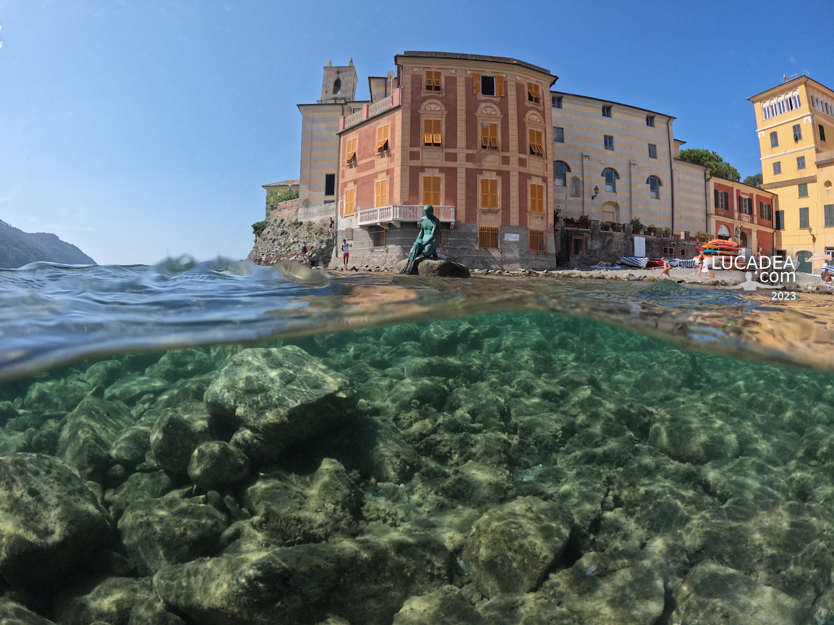
The statue of the Fisherman from inside the sea in Sestri Levante.
Last summer I had fun taking several photos of the Baia del Silensio, the famous natural inlet of my town, Sestri Levante, from inside the sea with the latest gadget I bought for the Gopro (the dome).
The photos, out of a hundred or so, a couple came out decently, they are very particular and I like them very much.
In this one there is the statue of the Fisherman with the rocks at the water's edge in the foreground and the Ex Convento dell'Annunziata in the background.

Have you ever been to Sestri Levante and seen the Bay of Silence?
Add your own comment or go to the bottom of the site to read what other visitors have written.

La statua del Pescatore da dentro il mare a Sestri Levante

Photo taken with Gopro Hero 10 black and Telesin Dome Port.

Here are also a couple of videos taken from the water:

Videos recorded withGopro Hero 10 Black and Telesin Dome Port.

The statue of the Fisherman from inside the sea in Sestri Levante – La statue du pêcheur de l’intérieur de la mer à Sestri Levante – La estatua del Pescador desde el interior del mar en Sestri Levante – A estátua do Pescador de dentro do mar em Sestri Levante – Die Statue des Fischers aus dem Meer in Sestri Levante – Bức tượng Người đánh cá từ trong biển ở Sestri Levante – 塞斯特里莱万特海内渔夫的雕像 – セストリ・レバンテの海の中から見た漁師の像

The Bay of Silence photographed on May 9, 2023

La Baia del Silenzio fotografata il 9 maggio 2023

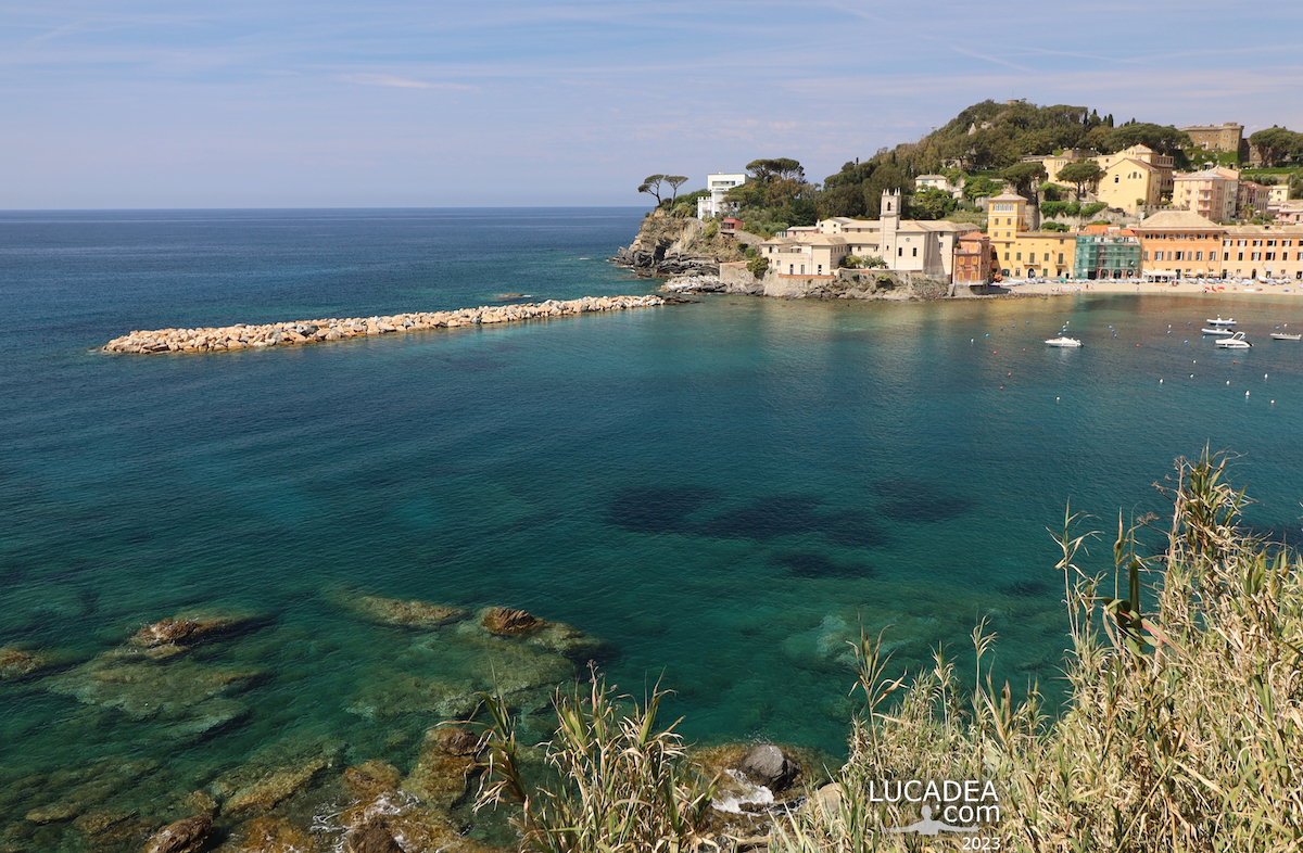
The Bay of Silence photographed on May 9, 2023.
A few weeks ago I brought the old wide-angle lens to the Bay of Silence to test it together with the new camera.
You can see the result with your own eyes also because in May the water is very clean and emerald in color.

Do you like Sestri Bay?
Add your own comment or go to the bottom of the site to read what other visitors have written.

La Baia del Silenzio fotografata il 9 maggio 2023

La Baia del Silenzio fotografata il 9 maggio 2023

La Baia del Silenzio fotografata il 9 maggio 2023

La Baia del Silenzio fotografata il 9 maggio 2023

La Baia del Silenzio fotografata il 9 maggio 2023

La Baia del Silenzio fotografata il 9 maggio 2023

Photo taken with Canon EOS RP and lens Canon EF-S 10-18.

The Bay of Silence photographed on May 9, 2023 – La baie du silence photographiée le 9 mai 2023 – La Bahía del Silencio fotografiada el 9 de mayo de 2023 – A Baía do Silêncio fotografada em 9 de maio de 2023 – Die Bucht der Stille, fotografiert am 9. Mai 2023 – Vịnh Im Lặng được chụp vào ngày 9 tháng 5 năm 2023 – 沉默湾,拍摄于 2023 年 5 月 9 日 – 2023 年 5 月 9 日に撮影された静寂の湾

The beautiful village of Bogliasco seen from inside the sea water

Il bel borgo di Bogliasco visto da dentro l'acqua del mare

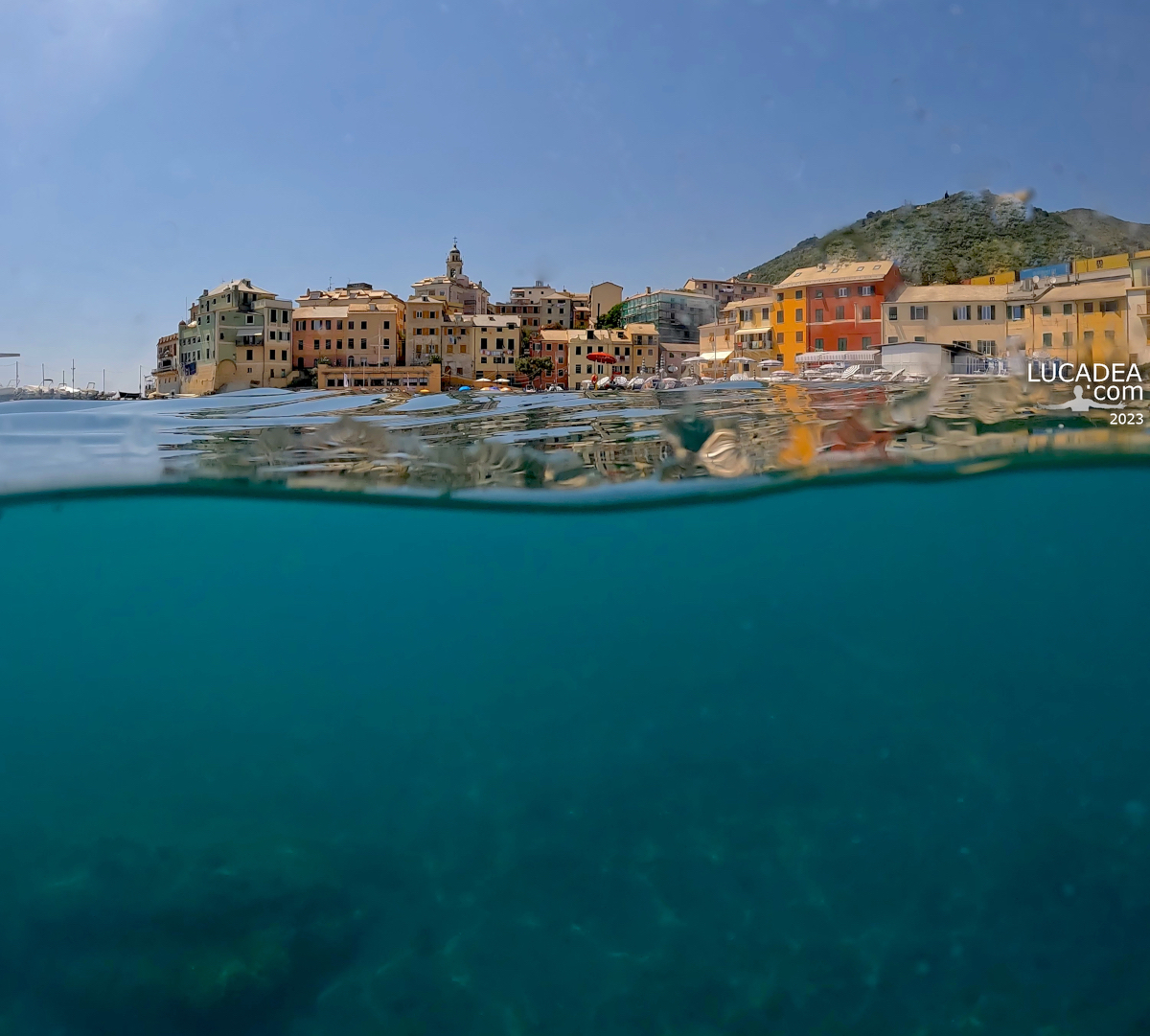
The beautiful village of Bogliasco seen from inside the sea water.
My wanderings with the dome and the Gopro continue around the edges of Eastern Liguria.
Unfortunately there are still too many drops of water but in any case among all the photos I took two are still decent enough to publish (I hope).
Here is the beautiful village of the Golfo Paradiso seen from the sea. I promise to return when I have more practice.

Do you know or have you ever been to Bogliasco?
Add your own comment or go to the bottom of the site to read what other visitors have written.

Il bel borgo di Bogliasco visto da dentro l'acqua del mare

Il bel borgo di Bogliasco visto da dentro l'acqua del mare

Photo taken with Gopro Hero 10 black and Telesin Dome Port..

And here are some videos I made on another visit:

Videos recorded with Gopro Hero 10 Black.

To see all the photos I took in the village click here:
foto gallery

It is the first municipality you come across when travelling from Genoa towards the Riviera di Levante, in a small inlet at the mouth of the river of the same name. Among the reliefs of the territory there is Mount Cordona (803 m) along the ancient path to the hamlet of Sessarego and Mount Rotondo (789 m). The beaches alternate with deep and characteristic cliffs. It is possible to practice surfing there. The hinterland is typical of eastern Liguria, partly with strips of olive groves, with the possibility of excursions.
Continue and learn more on Wikipedia

The beautiful village of Bogliasco seen from inside the sea water – Le beau village de Bogliasco vu de l’intérieur de l’eau de mer – El hermoso pueblo de Bogliasco visto desde el interior del agua de mar – A bela vila de Bogliasco vista de dentro da água do mar – Das schöne Dorf Bogliasco aus dem Meerwasser gesehen – Ngôi làng Bogliasco xinh đẹp nhìn từ trong làn nước biển – 从海水中看到美丽的博格利亚斯科村庄 – 海水の中から見たボリアスコの美しい村

Mare da sogno: le calette lungo la passeggiata di Framura

Mare da sogno: le calette lungo la passeggiata di Framura

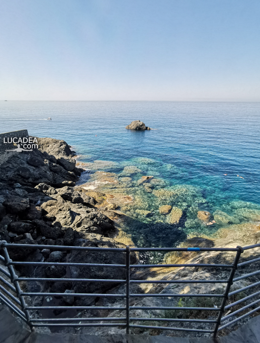
Mare da sogno: le calette lungo la passeggiata di Framura.
L’estate scorsa, dopo molto tempo che me lo ripromettevo, sono finalmente stato al mare a Framura, il piccolissimo paese verso le Cinque Terre.
Si arriva alla stazione ferroviaria e poi, attraverso il sottopassaggio della stessa, si raggiunge la piccola passeggiata a mare che collega le varie calette e le incantevoli spiaggette.
Armatevi di maschere e pinne perche’ ne vale proprio la pena e, se non volete spendere qualche euro per un lettino ed ombrellone (e si’ incredibilmente ci sono anche quelli a disposizione) portatevi molta crema solare!

Conosci o sei mai stato a Framura? Aggiungi un comment or go to the bottom of the site to read what other visitors have written.

Mare da sogno: le calette lungo la passeggiata di Framura

Photo taken with Honor 20.

Situated on the Ligurian coast, the small town of Framura is located within one of the many inlets and coves, typical of the rugged coast of the eastern Ligurian Riviera. Mount Serro (421 m. above sea level) is the highest peak in the Framura area and belongs to the protected area of ​​the Cinque Terre.
Continue on Wikipedia

Here's where the walk is located:

Dream sea: the coves along the Framura promenade – Mer de rêve : les criques le long de la promenade de Framura – Mar de ensueño: las calas del paseo Framura – Mar dos sonhos: as enseadas ao longo do calçadão de Framura – Traummeer: ​​die Buchten entlang der Framura-Promenade – Biển mơ: những vịnh nhỏ dọc theo lối đi dạo Framura – 梦幻之海:沿着 Framura 长廊的小海湾 – 夢の海:フラムラ遊歩道沿いの入り江

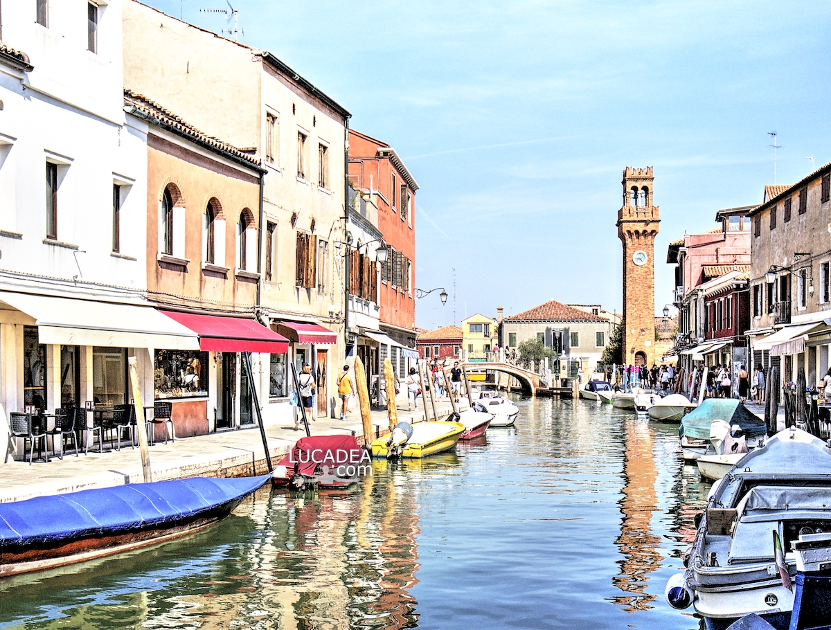
La Torre Civica di Murano riflessa nell’acqua del canale

La Torre Civica di Murano riflessa nell'acqua del canale

La Torre Civica di Murano riflessa nell’acqua del canale.
Una gita a Venezia di qualche mese fa mi ha portato, finalmente, a visitare la bella isola di Murano (e anche quella di Burano).
Molto bello passeggiare lungo i canali dell’isola a vedere le vetrine ricolme di “gioielli” di vetro così famosi nel mondo.

Hai mai visitato la bella isola di Murano? Vuoi vedere qualche oggetto in vetro acquistabile online? Clicca qui!
Se invece vuoi lasciare un commento clicca here.

La Torre Civica di Murano riflessa nell'acqua del canale

Photo taken with Canon EOS M100 and lens Canon EF-M 11-22.

Per vedere tutte le foto che ho scattato nella isola veneta clicca here:

Le isole su cui sorge Murano sono poste lungo il canale dei Marani e sono divise da canali e rii e collegate tra loro da ponti; il loro territorio è totalmente urbanizzato, escludendo Sacca San Mattia, tuttora in fase di bonifica. Due isole sono di origine artificiale: Sacca Serenella e Sacca San Mattia. Il centro è noto in tutto il mondo per la plurisecolare attività artigianale che produce il vetro di Murano.
Continue and learn more on Wikipedia

The Civic Tower of Murano reflected in the water of the canal – La tour civique de Murano reflétée dans l’eau du canal – La Torre Cívica de Murano reflejada en el agua del canal – A torre cívica de Murano refletida na água do canal – Der Civic Tower von Murano spiegelt sich im Wasser des Kanals – Tháp Civic của Murano phản chiếu trên mặt nước của kênh đào – 穆拉诺市民塔倒映在运河的水中 – 運河の水面に映るムラーノのシビック タワー

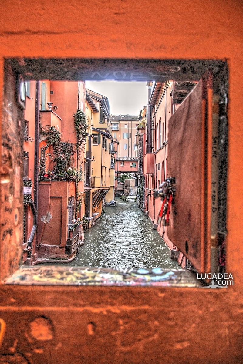
The Little Window of Via Piella, the Venice of Bologna

La Finestrella di via Piella, la Venezia di Bologna

The Little Window in Via Piella, the Venice of Bologna.
One of the places usually mentioned among the secrets of the city (but which at this point has become one of the most visited and photographed tourist places) is this small window which, if opened, shows one of the last remaining canals in Bologna.
It really seems like you are in Venice.

Have you ever been to Bologna and seen this place? Add a comment or go to the bottom of the site to read what other visitors have written.

Photo taken with Canon EOS M100 and lens Tamron 16-300.

If you want to see all the photos I took in the city, click here:

The Bolognese water network was gradually developed between the 12th and 16th centuries, starting from the two fundamental works, namely the locks of San Ruffillo and Casalecchio, on the Savena torrent and the Reno river respectively, initially made necessary to increase the number of grain mills and to feed the moat of the second circle of city walls.
Continue and learn more on Wikipedia

The window of via Piella, the Venice of Bologna – La fenêtre de via Piella, la Venise de Bologne – La ventana de via Piella, la Venecia de Bolonia – A janela da via Piella, a Veneza de Bolonha – Das Fenster der Via Piella, dem Venedig von Bologna – Cửa sổ qua Piella, Venice của Bologna – Via Piella 的窗口,博洛尼亚的威尼斯 – ボローニャのヴェネツィア、ピエラ通りの窓