La spettacolare vista dalla cima del Monte Zatta

La spettacolare vista dalla cima del Monte Zatta

La spettacolare vista dalla cima del Monte Zatta.
Qualche tempo fa, ormai, ero stato a camminare lungo il sentiero ad anello del Monte Zatta.
Una delle passeggiate più belle che io ricordi di aver percorso con, all’apice, la spettacolare vista che si gode dalla cima!

Have you ever hiked this trail? Add a comment or go to the bottom of the site to read what other visitors have written.

Photo taken with Gopro Hero 10 black.

I took several photos along the Monte Zatta path and if you want to see them go to this page:

To see in detail the path I took I invite you to go to wikiloc.com.

Here's where the top is:

The summit of the Zatta mountain massif consists of a long wavy ridge, crossed by an easy ridge path. On the outer edges of this ridge are the Zatta di Ponente mountain (1355 m) and the Prato Pinello mountain (1390 m). Between the two ends rises the main peak, the Zatta di Levante mountain (1404 m). The southern slope is steep and stony, while the northern slope, towards the Bocco pass, has a gentler slope and is covered by a large beech forest.
Continue and learn more on Wikipedia

One of the peaks of Monte Zatta on the Alta Via of the Ligurian mountains – L’un des sommets du Monte Zatta sur l’Alta Via des montagnes liguriennes – Uno de los picos del Monte Zatta en la Alta Vía de las montañas de Liguria – Um dos picos do Monte Zatta na Alta Via das montanhas da Ligúria – Einer der Gipfel des Monte Zatta auf der Alta Via der ligurischen Berge – Một trong những đỉnh của Monte Zatta trên Alta Via của dãy núi Ligurian – 利古里亚山脉阿尔塔大道上的蒙特扎塔峰之一 – リグリア山脈のアルタビアにあるモンテザッタの山頂の1つ

The ridge of Mount Zatta on the Alta Via in Liguria

Il crinale del Monte Zatta ed il bellissimo sentiero che lo attraversa

The crest of Monte Zatta and the beautiful path that crosses it.
Travelling along the Alta Via dei monti liguri you also pass by Monte Zatta and its crests.
One of the most beautiful paths I have ever walked (a couple of years ago now).

Have you ever been on this trail? Add a comment or go to the bottom of the site to read what other visitors have written.

Il crinale del Monte Zatta ed il bellissimo sentiero che lo attraversa

Photo taken with Canon EOS M100 and lens Tamron 16-300.

I took several photos along the Monte Zatta path and if you want to see them go to this page:

To see in detail the path I took I invite you to go to wikiloc.com.

The summit of the Zatta mountain massif consists of a long wavy ridge, crossed by an easy ridge path. On the outer edges of this ridge are the Zatta di Ponente mountain (1355 m) and the Prato Pinello mountain (1390 m). Between the two ends rises the main peak, the Zatta di Levante mountain (1404 m). The southern slope is steep and stony, while the northern slope, towards the Bocco pass, has a gentler slope and is covered by a large beech forest.
Continue and learn more on Wikipedia

The crest of Monte Zatta in Liguria – La crête du Monte Zatta en Ligurie – La cresta del Monte Zatta en Liguria – A crista do Monte Zatta na Ligúria – Der Kamm des Monte Zatta in Ligurien – Đỉnh của Monte Zatta ở Liguria – 利古里亚蒙特扎塔峰 – リグリアのモンテザッタの紋章

La cresta del Monte Ramaceto vista dal Monte Caucaso

La cresta del Monte Ramaceto vista dal Monte Caucaso

La cresta del Monte Ramaceto vista dal Monte Caucaso.
Una delle prossime cime che devo salire è il Monte Ramaceto qui fotografato dal sentiero ad anello che sale al Monte Caucaso.
Alto poco più di 1300 metri è una delle cime che dominano l’entroterra del Levante ligure e che fa parte dell’Alta Via dei Monti Liguri (AV).
Molto bello!

Sei mai stato su questa montagna? Lascia un commento cliccando here.

La cresta del Monte Ramaceto vista dal Monte Caucaso

Photo taken with Canon 600D and lens Tamron 16-300.

The crest of Mount Ramaceto seen from Mount Caucasus – La crête du mont Ramaceto vue du mont Caucase – La cresta del monte Ramaceto vista desde el monte Cáucaso – A crista do Monte Ramaceto visto do Monte Cáucaso – Der Kamm des Mount Ramaceto vom Kaukasus aus gesehen – Đỉnh của Núi Ramaceto nhìn từ Núi Caucasus – 从高加索山看到的拉马塞托山峰 – コーカサス山から見たラマセト山の頂上

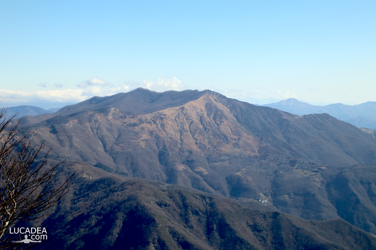
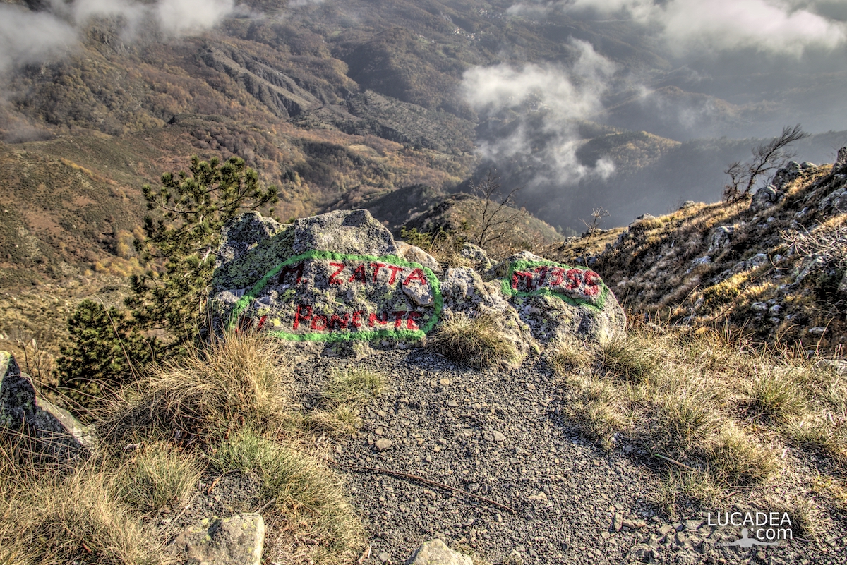
One of the peaks of Mount Zatta on the Alta Via

Una delle cime del Monte Zatta sulla Alta Via dei monti liguri

One of the peaks of Mount Zatta on the Alta Via dei monti liguri.
the western peak of Mount Zatta, which is located at 1355 meters above sea level, offers a truly spectacular view.
It is one of the most beautiful paths I have ever walked and runs along a stretch of the Alta Via (AV) of the Ligurian mountains.

Have you ever walked this trail?
Add your own comment or go to the bottom of the site to read what other visitors have written.

Una delle cime del Monte Zatta sulla Alta Via dei monti liguri

Photo taken with Canon EOS M100 and lens Tamron 16-300.

I took several photos along the Monte Zatta path and if you want to see them go to this page:

To see in detail the path I took I invite you to go to wikiloc.com.

Here's where the top is:

The summit of the Zatta mountain massif consists of a long wavy ridge, crossed by an easy ridge path. On the outer edges of this ridge are the Zatta di Ponente mountain (1355 m) and the Prato Pinello mountain (1390 m). Between the two ends rises the main peak, the Zatta di Levante mountain (1404 m). The southern slope is steep and stony, while the northern slope, towards the Bocco pass, has a gentler slope and is covered by a large beech forest.
Continue and learn more on Wikipedia

One of the peaks of Monte Zatta on the Alta Via of the Ligurian mountains – L’un des sommets du Monte Zatta sur l’Alta Via des montagnes liguriennes – Uno de los picos del Monte Zatta en la Alta Vía de las montañas de Liguria – Um dos picos do Monte Zatta na Alta Via das montanhas da Ligúria – Einer der Gipfel des Monte Zatta auf der Alta Via der ligurischen Berge – Một trong những đỉnh của Monte Zatta trên Alta Via của dãy núi Ligurian – 利古里亚山脉阿尔塔大道上的蒙特扎塔峰之一 – リグリア山脈のアルタビアにあるモンテザッタの山頂の1つ

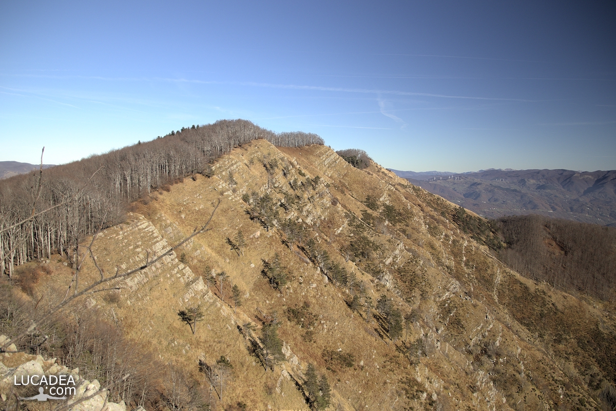
La cresta del Monte Zatta in Liguria

La cresta del Monte Zatta in Liguria

La cresta del Monte Zatta in Liguria.
Diverso tempo fa ho percorso un sentiero che al momento e’ uno dei più belli che abbia mai fatto.
Percorre un tratto della famosa Alta Via dei Monti Liguri (segnale AV) e parte dal Passo del Bocco per arrivare alle diverse cime del massiccio dello Zatta.
Cime che, come potete vedere dalla foto, sono collegate da una lunga e spettacolare cresta rocciosa che si percorre.

Sei mai stato su questo sentiero? Se hai domande oppure se vuoi farmi sapere la tua opinione su questo articolo lascia un commento cliccando here.

La cresta del Monte Zatta in Liguria

Photo taken with Canon EOS M100 and lens Tamron 16-300.

I took several photos along the Monte Zatta path and if you want to see them go to this page:

To see in detail the path I took I invite you to go to wikiloc.com.

The summit of the Zatta mountain massif consists of a long wavy ridge, crossed by an easy ridge path. On the outer edges of this ridge are the Zatta di Ponente mountain (1355 m) and the Prato Pinello mountain (1390 m). Between the two ends rises the main peak, the Zatta di Levante mountain (1404 m). The southern slope is steep and stony, while the northern slope, towards the Bocco pass, has a gentler slope and is covered by a large beech forest.
Continue and learn more on Wikipedia

The crest of Monte Zatta in Liguria – La crête du Monte Zatta en Ligurie – La cresta del Monte Zatta en Liguria – A crista do Monte Zatta na Ligúria – Der Kamm des Monte Zatta in Ligurien – Đỉnh của Monte Zatta ở Liguria – 利古里亚蒙特扎塔峰 – リグリアのモンテザッタの紋章

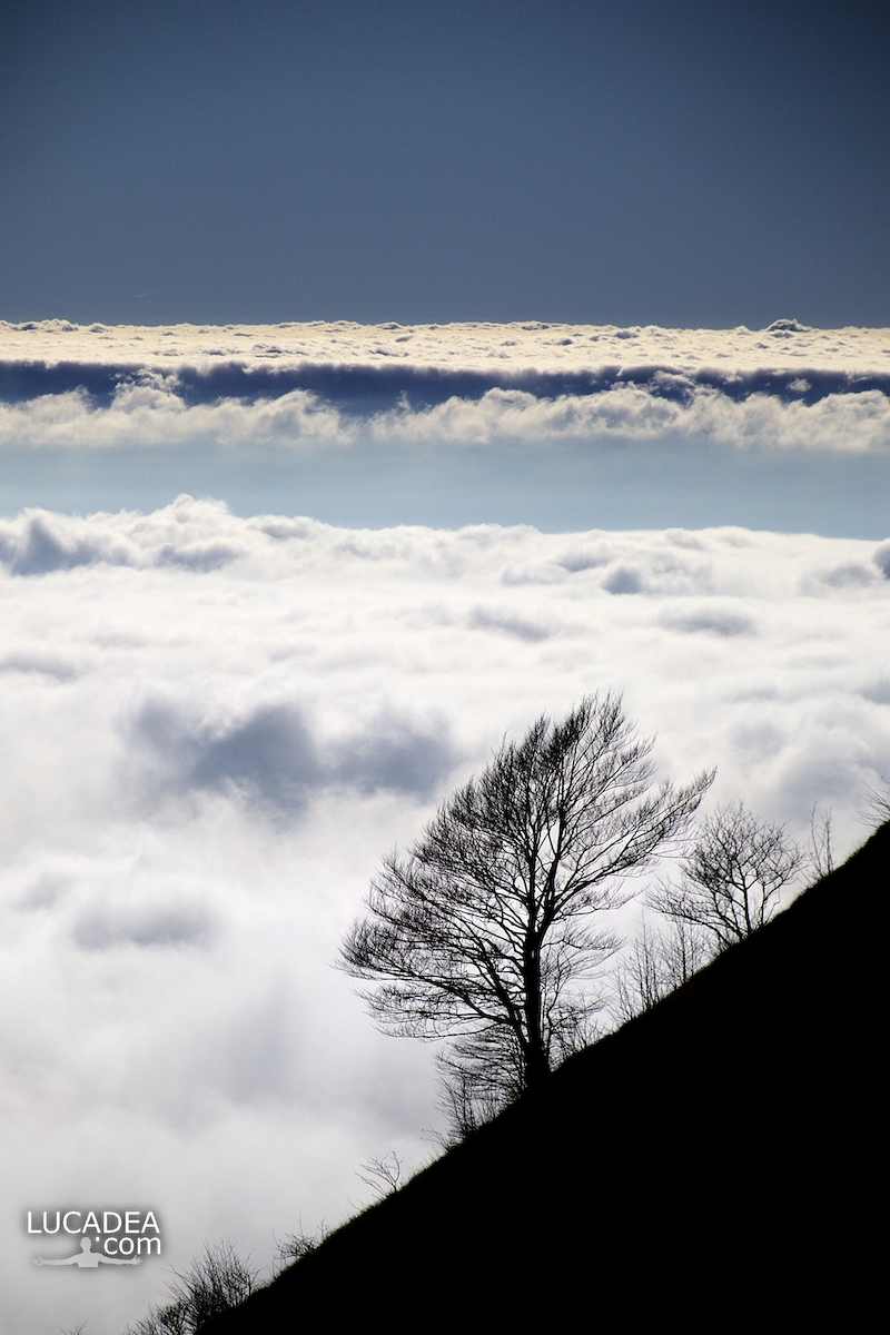
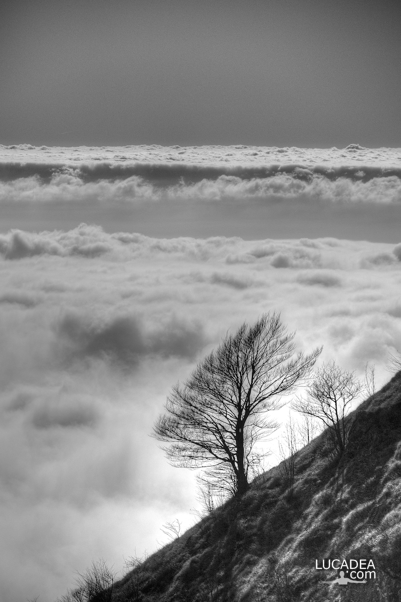
Un albero sulle nuvole dal Monte Zatta

Un albero con alle spalle un tappeto di nuvole visto dal Monte Zatta

Un albero con alle spalle un tappeto di nuvole visto dal Monte Zatta.
Diverso tempo fa ho percorso lo splendido sentiero del Monte Zatta con partenda dal Passo del Bocco.
Uno dei sentieri più belli che abbia mai percorso.
Sulla cima c’era quest’albero con alle spalle tutte queste nuvole che sembravano un tappeto!
Ho scattato due foto: a colori ed in bianco e nero.

Have you ever been on this trail? Add a comment or go to the bottom of the site to read what other visitors have written.

Photo taken with Canon EOS M100 and lens Tamron 16-300.

I took several photos along the Monte Zatta path and if you want to see them go to this page:

To see in detail the path I took I invite you to go to wikiloc.com.

The summit of the Zatta mountain massif consists of a long wavy ridge, crossed by an easy ridge path. On the outer edges of this ridge are the Zatta di Ponente mountain (1355 m) and the Prato Pinello mountain (1390 m). Between the two ends rises the main peak, the Zatta di Levante mountain (1404 m). The southern slope is steep and stony, while the northern slope, towards the Bocco pass, has a gentler slope and is covered by a large beech forest.
Continue and learn more on Wikipedia
A tree with a carpet of clouds behind it seen from Monte Zatta – Un arbre avec un tapis de nuages ​​derrière vu de Monte Zatta – Un árbol con una alfombra de nubes detrás visto desde Monte Zatta – Uma árvore com um tapete de nuvens atrás vista do Monte Zatta – Ein Baum mit einem Wolkenteppich dahinter vom Monte Zatta aus gesehen – Cây với thảm mây phía sau nhìn từ Monte Zatta – 从 Monte Zatta 看到的一棵树,背后有一层云层 – モンテザッタから見た背後に雲のカーペットがある木

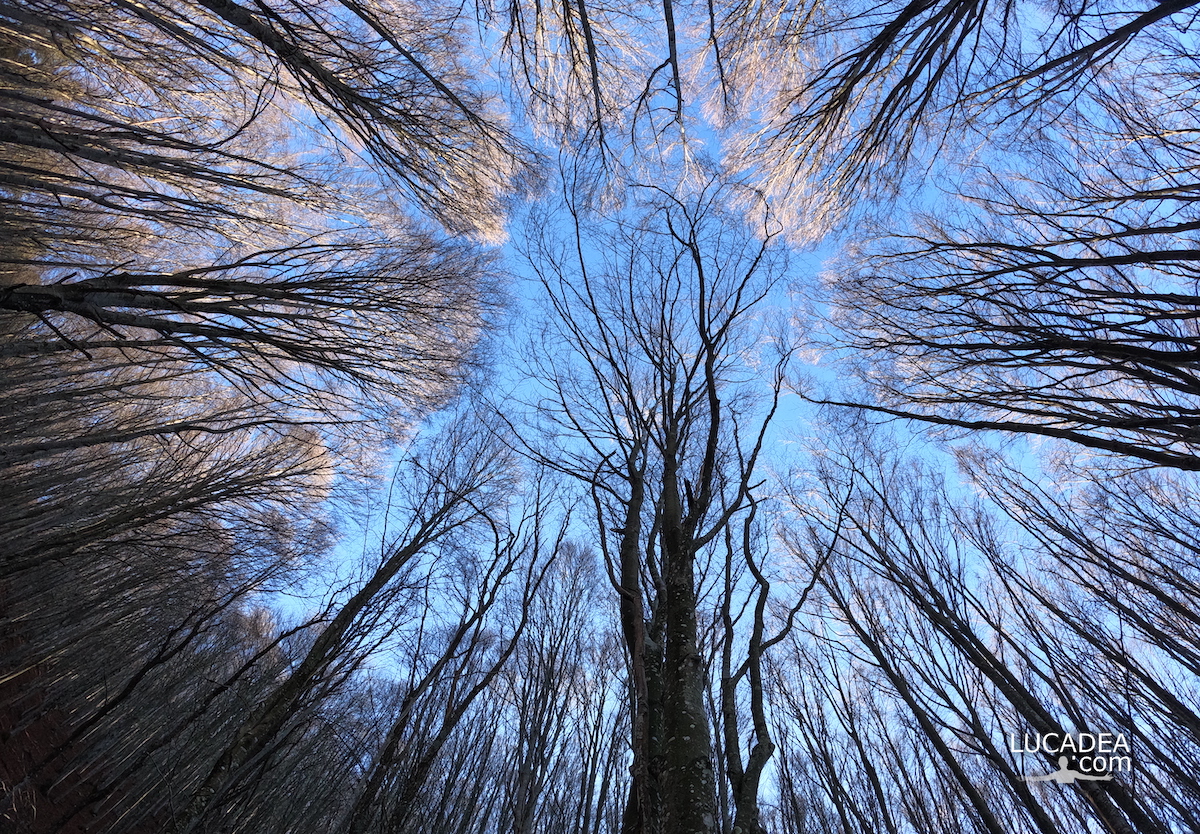
Le fronde degli alberi nella faggeta del Monte Zatta

Le fronde degli alberi nella faggeta del Monte Zatta

Le fronde degli alberi nella faggeta del Monte Zatta.
Qualche mese fa ormai (a fine novembre) sono stato sul Monte Zatta e ho percorso il sentiero da anello che parte dal Passo del Bocco.
Veramente una bella passeggiata di circa dieci chilometri (che ho percorso in cinque ore senza correre) che attraversa il bellissimo bosco quasi interamente composto da faggi. Una delle più belle faggete di Liguria.

Sei mai stato su questo sentiero? Se hai domande oppure se vuoi farmi sapere la tua opinione su questo articolo lascia un commento cliccando here.

Le fronde degli alberi nella faggeta del Monte Zatta

Photo taken with Gopro Hero 10 black.

I took several photos along the Monte Zatta path and if you want to see them go to this page:

To see in detail the path I took I invite you to go to wikiloc.com.

The summit of the Zatta mountain massif consists of a long wavy ridge, crossed by an easy ridge path. On the outer edges of this ridge are the Zatta di Ponente mountain (1355 m) and the Prato Pinello mountain (1390 m). Between the two ends rises the main peak, the Zatta di Levante mountain (1404 m). The southern slope is steep and stony, while the northern slope, towards the Bocco pass, has a gentler slope and is covered by a large beech forest.
Continue and learn more on Wikipedia
The fronds of the trees in the beech forest of Monte Zatta – Les frondes des arbres dans la forêt de hêtres de Monte Zatta – Las frondas de los árboles en el hayedo de Monte Zatta – Die Wedel der Bäume im Buchenwald des Monte Zatta – Lá cây trong rừng sồi ở Monte Zatta