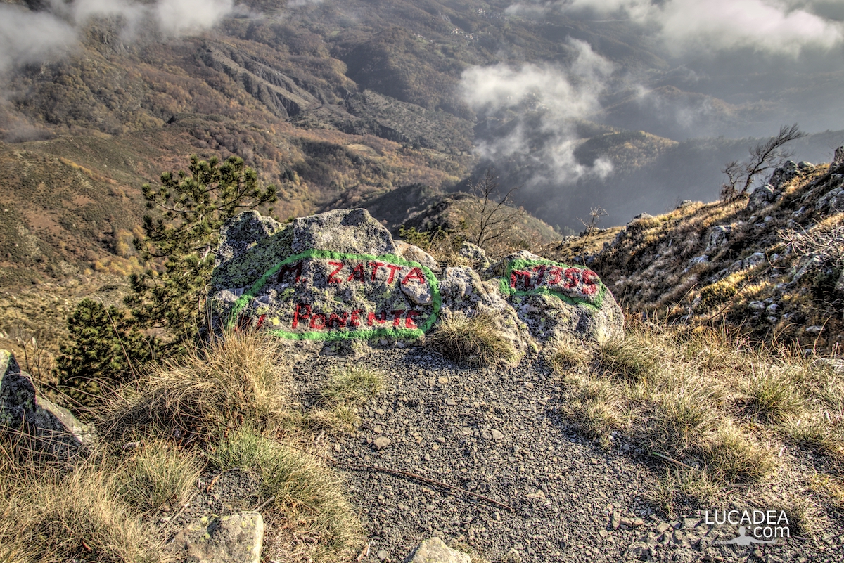
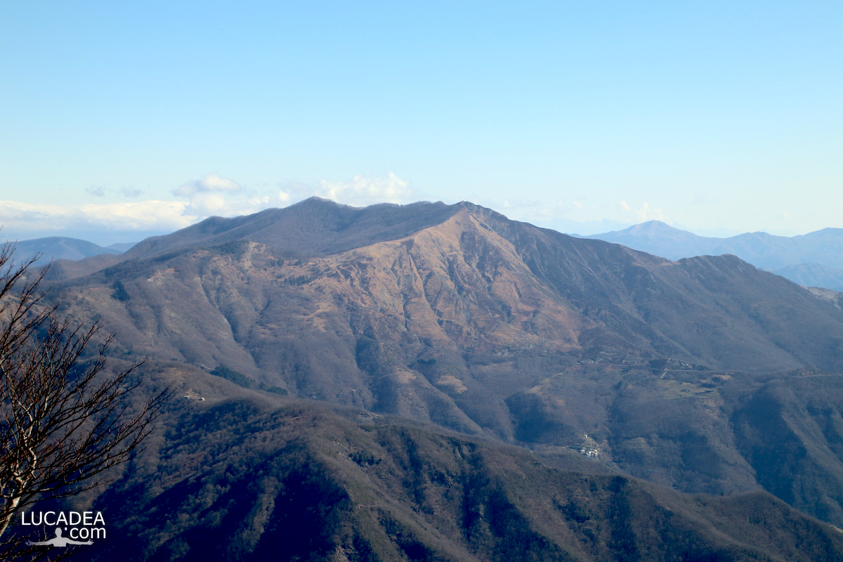
La spettacolare vista dalla cima del Monte Zatta

La spettacolare vista dalla cima del Monte Zatta

La spettacolare vista dalla cima del Monte Zatta.
Qualche tempo fa, ormai, ero stato a camminare lungo il sentiero ad anello del Monte Zatta.
Una delle passeggiate più belle che io ricordi di aver percorso con, all’apice, la spettacolare vista che si gode dalla cima!

Have you ever hiked this trail? Add a comment or go to the bottom of the site to read what other visitors have written.

Photo taken with Gopro Hero 10 black.

I took several photos along the Monte Zatta path and if you want to see them go to this page:

To see in detail the path I took I invite you to go to wikiloc.com.

Here's where the top is:

The summit of the Zatta mountain massif consists of a long wavy ridge, crossed by an easy ridge path. On the outer edges of this ridge are the Zatta di Ponente mountain (1355 m) and the Prato Pinello mountain (1390 m). Between the two ends rises the main peak, the Zatta di Levante mountain (1404 m). The southern slope is steep and stony, while the northern slope, towards the Bocco pass, has a gentler slope and is covered by a large beech forest.
Continue and learn more on Wikipedia

One of the peaks of Monte Zatta on the Alta Via of the Ligurian mountains – L’un des sommets du Monte Zatta sur l’Alta Via des montagnes liguriennes – Uno de los picos del Monte Zatta en la Alta Vía de las montañas de Liguria – Um dos picos do Monte Zatta na Alta Via das montanhas da Ligúria – Einer der Gipfel des Monte Zatta auf der Alta Via der ligurischen Berge – Một trong những đỉnh của Monte Zatta trên Alta Via của dãy núi Ligurian – 利古里亚山脉阿尔塔大道上的蒙特扎塔峰之一 – リグリア山脈のアルタビアにあるモンテザッタの山頂の1つ

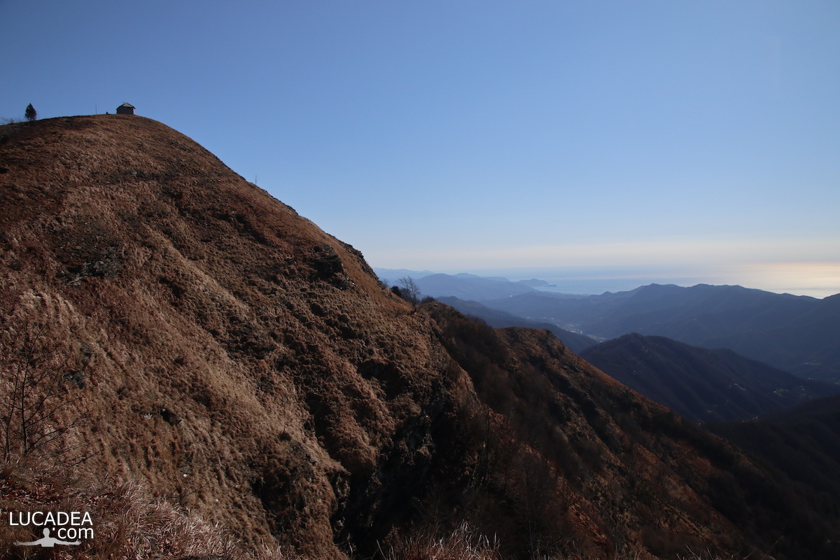
The ridge of Mount Zatta on the Alta Via in Liguria

Il crinale del Monte Zatta ed il bellissimo sentiero che lo attraversa

The crest of Monte Zatta and the beautiful path that crosses it.
Travelling along the Alta Via dei monti liguri you also pass by Monte Zatta and its crests.
One of the most beautiful paths I have ever walked (a couple of years ago now).

Have you ever been on this trail? Add a comment or go to the bottom of the site to read what other visitors have written.

Il crinale del Monte Zatta ed il bellissimo sentiero che lo attraversa

Photo taken with Canon EOS M100 and lens Tamron 16-300.

I took several photos along the Monte Zatta path and if you want to see them go to this page:

To see in detail the path I took I invite you to go to wikiloc.com.

The summit of the Zatta mountain massif consists of a long wavy ridge, crossed by an easy ridge path. On the outer edges of this ridge are the Zatta di Ponente mountain (1355 m) and the Prato Pinello mountain (1390 m). Between the two ends rises the main peak, the Zatta di Levante mountain (1404 m). The southern slope is steep and stony, while the northern slope, towards the Bocco pass, has a gentler slope and is covered by a large beech forest.
Continue and learn more on Wikipedia

The crest of Monte Zatta in Liguria – La crête du Monte Zatta en Ligurie – La cresta del Monte Zatta en Liguria – A crista do Monte Zatta na Ligúria – Der Kamm des Monte Zatta in Ligurien – Đỉnh của Monte Zatta ở Liguria – 利古里亚蒙特扎塔峰 – リグリアのモンテザッタの紋章

La cresta del Monte Ramaceto vista dal Monte Caucaso

La cresta del Monte Ramaceto vista dal Monte Caucaso

La cresta del Monte Ramaceto vista dal Monte Caucaso.
Una delle prossime cime che devo salire è il Monte Ramaceto qui fotografato dal sentiero ad anello che sale al Monte Caucaso.
Alto poco più di 1300 metri è una delle cime che dominano l’entroterra del Levante ligure e che fa parte dell’Alta Via dei Monti Liguri (AV).
Molto bello!

Sei mai stato su questa montagna? Lascia un commento cliccando here.

La cresta del Monte Ramaceto vista dal Monte Caucaso

Photo taken with Canon 600D and lens Tamron 16-300.

The crest of Mount Ramaceto seen from Mount Caucasus – La crête du mont Ramaceto vue du mont Caucase – La cresta del monte Ramaceto vista desde el monte Cáucaso – A crista do Monte Ramaceto visto do Monte Cáucaso – Der Kamm des Mount Ramaceto vom Kaukasus aus gesehen – Đỉnh của Núi Ramaceto nhìn từ Núi Caucasus – 从高加索山看到的拉马塞托山峰 – コーカサス山から見たラマセト山の頂上

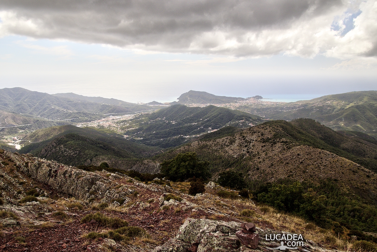
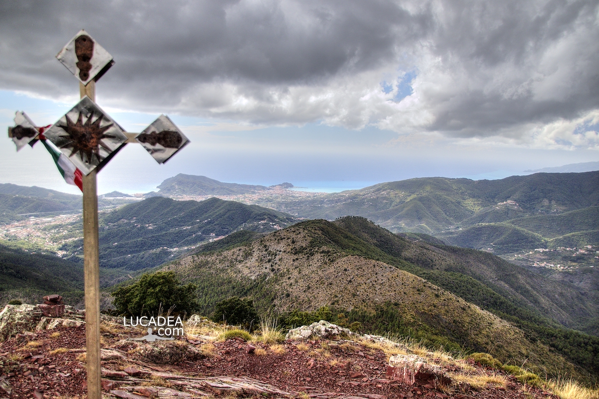
One of the peaks of Mount Zatta on the Alta Via

Una delle cime del Monte Zatta sulla Alta Via dei monti liguri

One of the peaks of Mount Zatta on the Alta Via dei monti liguri.
the western peak of Mount Zatta, which is located at 1355 meters above sea level, offers a truly spectacular view.
It is one of the most beautiful paths I have ever walked and runs along a stretch of the Alta Via (AV) of the Ligurian mountains.

Have you ever walked this trail?
Add your own comment or go to the bottom of the site to read what other visitors have written.

Una delle cime del Monte Zatta sulla Alta Via dei monti liguri

Photo taken with Canon EOS M100 and lens Tamron 16-300.

I took several photos along the Monte Zatta path and if you want to see them go to this page:

To see in detail the path I took I invite you to go to wikiloc.com.

Here's where the top is:

The summit of the Zatta mountain massif consists of a long wavy ridge, crossed by an easy ridge path. On the outer edges of this ridge are the Zatta di Ponente mountain (1355 m) and the Prato Pinello mountain (1390 m). Between the two ends rises the main peak, the Zatta di Levante mountain (1404 m). The southern slope is steep and stony, while the northern slope, towards the Bocco pass, has a gentler slope and is covered by a large beech forest.
Continue and learn more on Wikipedia

One of the peaks of Monte Zatta on the Alta Via of the Ligurian mountains – L’un des sommets du Monte Zatta sur l’Alta Via des montagnes liguriennes – Uno de los picos del Monte Zatta en la Alta Vía de las montañas de Liguria – Um dos picos do Monte Zatta na Alta Via das montanhas da Ligúria – Einer der Gipfel des Monte Zatta auf der Alta Via der ligurischen Berge – Một trong những đỉnh của Monte Zatta trên Alta Via của dãy núi Ligurian – 利古里亚山脉阿尔塔大道上的蒙特扎塔峰之一 – リグリア山脈のアルタビアにあるモンテザッタの山頂の1つ

La vista, molto in lontananza, di Sestri Levante dal Monte Caucaso

La vista, molto in lontananza, di Sestri Levante dal Monte Caucaso

La vista, molto in lontananza, di Sestri Levante dal Monte Caucaso.
Lo scorso inverno ho deciso di percorrere, dopo che da lungo tempo me lo riproponevo, il sentiero che arriva alla cima del Monte Caucaso (1245 m).
Oltre a dominare tutta la Val Fontanabuona offre una vista spettacolare anche sulla costa e, se vedete bene in lontananza, si vede la mia bella Sestri Levante.

Hai mai percorso questo sentiero? Lascia un commento cliccando here.

La vista, molto in lontananza, di Sestri Levante dal Monte Caucaso

Photo taken with Canon EOS M100 and lens Tamron 16-300.

This is the route I took: wikiloc.com.

To see all the photos I took along the trail click here:
foto gallery

And these are three nice videos I made that day, ascent, arrival and view:

Videos recorded with Gopro Hero 10 Black.

There are several paths that lead to the summit: among these, the path that starts from Scoglina and the steep path that goes up from Neirone. Another path starts from the village of Barbagelata, from where on New Year's Eve a torchlight procession is led on foot to the chapel dedicated to the Madonna located on the summit of the mountain.
Continue and learn more on Wikipedia

The distant view of Sestri Levante from Monte Caucaso – La vue lointaine de Sestri Levante depuis Monte Caucaso – La vista lejana de Sestri Levante desde el Monte Caucaso – A vista distante de Sestri Levante do Monte Cáucaso – Der Fernblick auf Sestri Levante vom Monte Caucaso – Khung cảnh xa xôi của Sestri Levante từ Monte Caucaso – 从高加索山看塞斯特里莱万特的远景 – モンテコーカソからのセストリレバンテの遠景

La vista sulla valle del Petronio dal Monte Groppi

La vista sulla valle del Petronio dal Monte Groppi

La vista sulla valle del Petronio dal Monte Groppi.
Qualche mese fa ho fatto uno splendido sentiero che dalla strada per il Passo del Bracco va sul Monte Nicolao e poi, volendo, sale anche fino alla cima del Monte Groppi che si trova sul confine tra il comune di Castiglione Chiavarese (GE) e il comune di Carro (SP).
Da lì si gode una vista eccezionale grazie ai 869 metri della cima!

Vi lascio anche un link ad un bell’articolo che vi spiega meglio il percorso che ho fatto: passeggiareinliguria.it. Aggiungi un comment or go to the bottom of the site to read what other visitors have written.

La vista sulla valle del Petronio dal Monte Groppi

Photo taken with Canon EOS M100 and lens Tamron 16-300.

Ho registrato anche un bel video dalla cima:

Videos recorded with Gopro Hero 10 Black.

Per vedere tutte le foto che ho scattato lungo il sentiero, clicca here:

The view over the Petronio valley from Mount Groppi – La vue sur la vallée de Petronio depuis le mont Groppi – Der Blick über das Petronio-Tal vom Monte Groppi – Quang cảnh thung lũng Petronio từ Núi Groppi

La vista dalla cima del Monte Treggin

La vista dalla cima del Monte Treggin

La vista dalla cima del Monte Treggin.
Dall’alto dei suoi ottocento e passa metri il Monte Treggin offre una vista spettacolare su Casarza Ligure e Sestri Levante.
Questa è proprio la vista dal punto più alto. Peccato che non era una giornata limpidissima ed il cielo era proprio nerissimo.

Hai mai fatto il sentiero che parte da Bargone e arriva alla cima del Treggin? Se hai domande oppure se vuoi farmi sapere la tua opinione su questo articolo lascia un commento cliccando here.

La vista dalla cima del Monte Treggin

Photo taken with Canon EOS M100 and lens Tamron 16-300.

To see all the photos I took along the trail click here:

The view from the top of Mount Treggin – Die Aussicht vom Gipfel des Mount Treggin – La vue depuis le sommet du mont Treggin – Quang cảnh từ đỉnh núi Treggin

La cima del Monte Treggin

La cima del Monte Treggin

La cima del Monte Treggin.
Uno dei monti più alti e da cui si vede la vista più bella su Sestri Levante è il Monte Treggin (870 metri).
Per arrivarvi ci sono diversi sentieri; tra tutti quelli possibili io ho deciso di fare quello che parte dal paese di bargone.
Giunti sulla cima c’è una bella cresta con un bel burrone sulla cui sommità che una croce.
Vista eccezionale!

Hai mai fatto il sentiero che parte da Bargone e arriva alla cima del Treggin? Se hai domande oppure se vuoi farmi sapere la tua opinione su questo articolo lascia un commento cliccando here.

La cima del Monte Treggin

Photo taken with Canon EOS M100 and lens Tamron 16-300.

To see all the photos I took along the trail click here:

The top of Mount Treggin – Die Spitze des Berges Treggin – Đỉnh núi Treggin

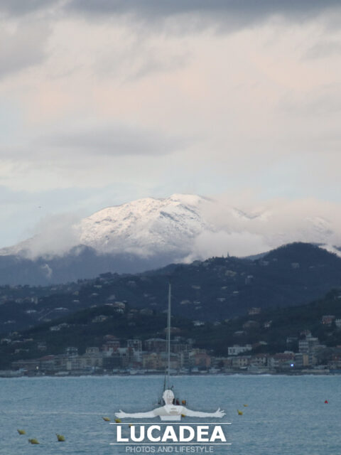
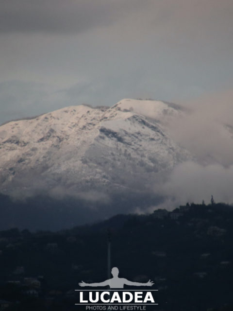
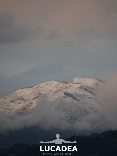
Il Monte Ramaceto fotografato con la neve da lontano

Monte Ramaceto con la neve

Il Monte Ramaceto fotografato con la neve da lontano.
In Liguria è così: nella stessa foto c’è sia il mare sia un monte con la neve.
Alto poco più di 1300 metri in questi giorni, come quasi tutti i monti dell’entroterra, la neve lo ha ricoperto abbondantemente così come si vede anche da Sestri Levante.

Ps: credo sia il Monte Ramaceto e sarei contento se qualche lettore esperto me lo potesse confermare!

Photo taken with Canon EOS M100 and lens Tamron 16-300.

La montagna si trova sull’alta via dei Monti Liguri e domina le valli Fontanabuona, Sturla e Aveto. Dalla sua vetta in giornate particolarmente terse, si possono vedere varie isole, tra cui la Corsica, l’Elba, il Giglio, l’isola di Montecristo, l’isola di Capraia.
Continue and learn more on Wikipedia
Mount Ramaceto photographed with snow from afar – Le mont Ramaceto photographié avec de la neige de loin – Monte Ramaceto fotografiado con nieve desde lejos – Monte Ramaceto fotografado com neve de longe – Mount Ramaceto mit Schnee aus der Ferne fotografiert – Núi Ramaceto chụp ảnh với tuyết từ xa – 从远处拍摄的拉马塞托山与雪 – 遠くから雪と一緒に撮影されたラマセト山

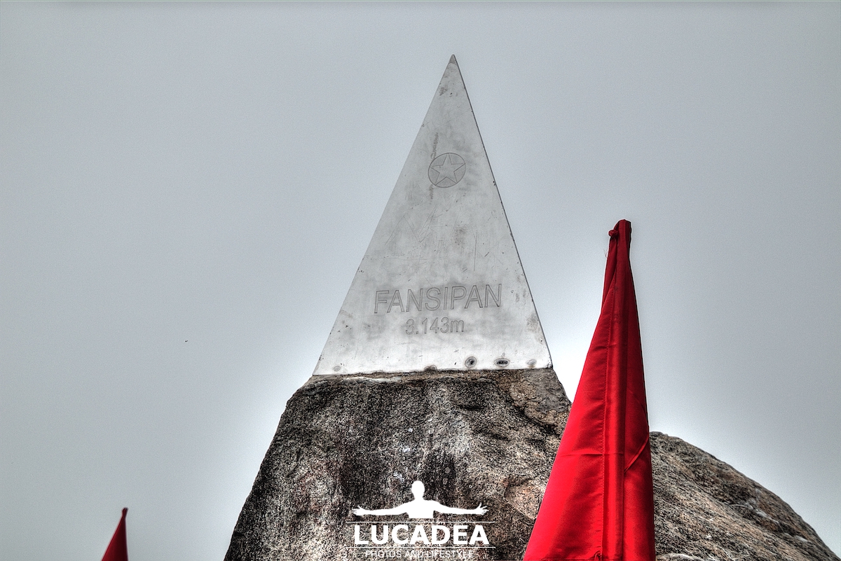
The summit of Fansipan in Vietnam

Cima del Fansipan in Vietnam

Fansipan peak in Vietnam.
Phan Xi Pang in Sa Pa.
The Sa Pa region is the most famous in Vietnam for its naturalistic aspect. In this region there is also the highest peak not only in the state but in the whole Indochinese region: Phan Xi Pang (in English Fansipan).
It is a mountain over 3000 meters high and it is a spectacle.
From its summit, from which however there is little view because there is almost always fog, you dominate the whole region.
You can reach the top of Fansipan by cable car… that trip alone would be enough!
Then at the top, there are temples, statues of Buddha, and steep, steep stairways.

Do you know Vietnam?
Add your own comment or go to the bottom of the site to read what other visitors have written.

Cima del Fansipan in Vietnam

Photo taken with Canon EOS M100 and lens Tamron 16-300.

This is a time-lapse video I shot that day:

Click here to see all the photos I took there:
foto gallery

Here's where the mountain is located:

The summit of Fansipan in Vietnam – Le sommet du Fansipan au Vietnam – La cumbre de Fansipan en Vietnam – A cimeira do Fansipan no Vietname – Der Gipfel des Fansipan in Vietnam – Đỉnh Fanxipan ở Việt Nam