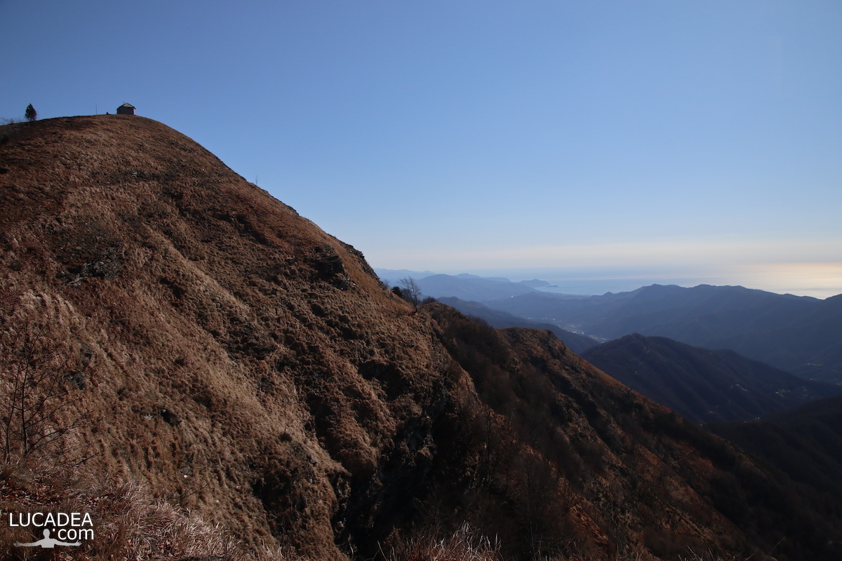
La vista, molto in lontananza, di Sestri Levante dal Monte Caucaso

La vista, molto in lontananza, di Sestri Levante dal Monte Caucaso

La vista, molto in lontananza, di Sestri Levante dal Monte Caucaso.
Lo scorso inverno ho deciso di percorrere, dopo che da lungo tempo me lo riproponevo, il sentiero che arriva alla cima del Monte Caucaso (1245 m).
Oltre a dominare tutta la Val Fontanabuona offre una vista spettacolare anche sulla costa e, se vedete bene in lontananza, si vede la mia bella Sestri Levante.

Hai mai percorso questo sentiero? Lascia un commento cliccando here.

La vista, molto in lontananza, di Sestri Levante dal Monte Caucaso

Photo taken with Canon EOS M100 and lens Tamron 16-300.

This is the route I took: wikiloc.com.

To see all the photos I took along the trail click here:
foto gallery

And these are three nice videos I made that day, ascent, arrival and view:

Videos recorded with Gopro Hero 10 Black.

There are several paths that lead to the summit: among these, the path that starts from Scoglina and the steep path that goes up from Neirone. Another path starts from the village of Barbagelata, from where on New Year's Eve a torchlight procession is led on foot to the chapel dedicated to the Madonna located on the summit of the mountain.
Continue and learn more on Wikipedia

The distant view of Sestri Levante from Monte Caucaso – La vue lointaine de Sestri Levante depuis Monte Caucaso – La vista lejana de Sestri Levante desde el Monte Caucaso – A vista distante de Sestri Levante do Monte Cáucaso – Der Fernblick auf Sestri Levante vom Monte Caucaso – Khung cảnh xa xôi của Sestri Levante từ Monte Caucaso – 从高加索山看塞斯特里莱万特的远景 – モンテコーカソからのセストリレバンテの遠景

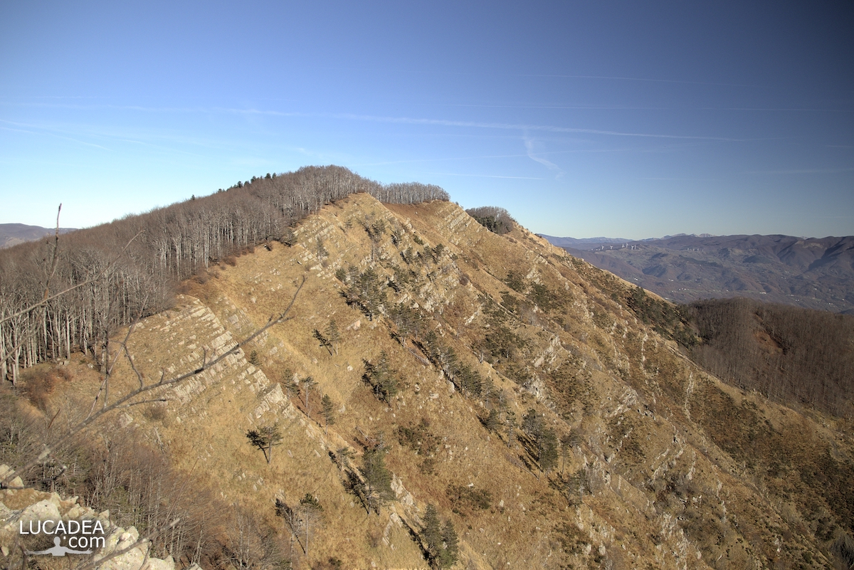
La cresta del Monte Zatta in Liguria

La cresta del Monte Zatta in Liguria

La cresta del Monte Zatta in Liguria.
Diverso tempo fa ho percorso un sentiero che al momento e’ uno dei più belli che abbia mai fatto.
Percorre un tratto della famosa Alta Via dei Monti Liguri (segnale AV) e parte dal Passo del Bocco per arrivare alle diverse cime del massiccio dello Zatta.
Cime che, come potete vedere dalla foto, sono collegate da una lunga e spettacolare cresta rocciosa che si percorre.

Sei mai stato su questo sentiero? Se hai domande oppure se vuoi farmi sapere la tua opinione su questo articolo lascia un commento cliccando here.

La cresta del Monte Zatta in Liguria

Photo taken with Canon EOS M100 and lens Tamron 16-300.

I took several photos along the Monte Zatta path and if you want to see them go to this page:

To see in detail the path I took I invite you to go to wikiloc.com.

The summit of the Zatta mountain massif consists of a long wavy ridge, crossed by an easy ridge path. On the outer edges of this ridge are the Zatta di Ponente mountain (1355 m) and the Prato Pinello mountain (1390 m). Between the two ends rises the main peak, the Zatta di Levante mountain (1404 m). The southern slope is steep and stony, while the northern slope, towards the Bocco pass, has a gentler slope and is covered by a large beech forest.
Continue and learn more on Wikipedia
The crest of Monte Zatta in Liguria – La crête du Monte Zatta en Ligurie – La cresta del Monte Zatta en Liguria – A crista do Monte Zatta na Ligúria – Der Kamm des Monte Zatta in Ligurien – Đỉnh của Monte Zatta ở Liguria – 利古里亚蒙特扎塔峰 – リグリアのモンテザッタの紋章

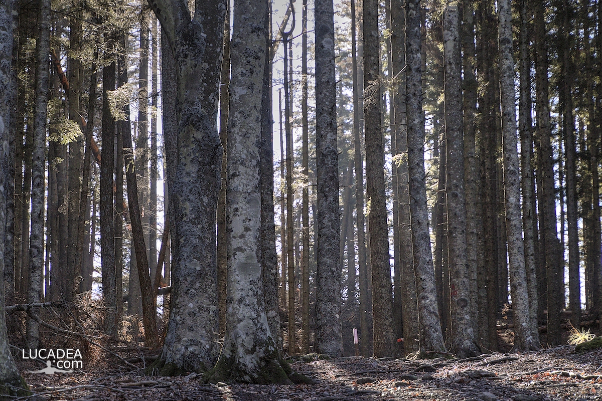
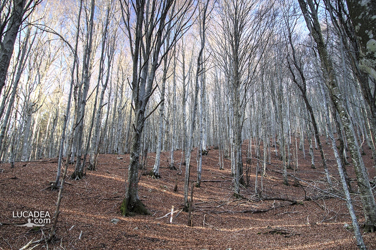
The beech trees of Mount Zatta in Liguria

Gli alberi di faggio del Monte Zatta in Liguria

The beech trees of Monte Zatta in Liguria.
Truly a beautiful path that of Monte Zatta that crosses one of the most beautiful and largest beech forests in Liguria (and perhaps in Italy). I really enjoyed photographing the light that filters through the straight trunks of these trees.

Have you ever been on this trail?
Add your own comment or go to the bottom of the site to read what other visitors have written.

Gli alberi di faggio del Monte Zatta in Liguria

Photo taken with Canon EOS M100 and lens Tamron 16-300.

I took several photos along the Monte Zatta path and if you want to see them go to this page:

To see in detail the path I took I invite you to go to wikiloc.com.

The summit of the Zatta mountain massif consists of a long wavy ridge, crossed by an easy ridge path. On the outer edges of this ridge are the Zatta di Ponente mountain (1355 m) and the Prato Pinello mountain (1390 m). Between the two ends rises the main peak, the Zatta di Levante mountain (1404 m). The southern slope is steep and stony, while the northern slope, towards the Bocco pass, has a gentler slope and is covered by a large beech forest.
Continue and learn more on Wikipedia

The beech trees of Monte Zatta in Liguria – Les hêtres du Monte Zatta en Ligurie – Las hayas del Monte Zatta en Liguria – As faias do Monte Zatta na Ligúria – Die Buchen des Monte Zatta in Ligurien – Những cây sồi ở Monte Zatta ở Liguria – 利古里亚蒙特扎塔山毛榉树 – リグリアのモンテザッタのブナの木

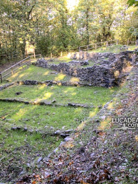
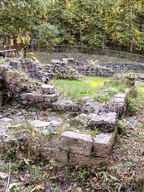
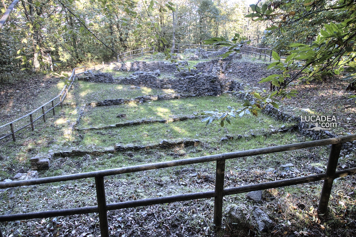
L’area archeologica dell’Ospedale di San Nicolao di Pietra Colice in Liguria

L'area archeologica dell'Ospedale di San Nicolao di Pietra Colice in Liguria

L’area archeologica dell’Ospedale di San Nicolao di Pietra Colice in Liguria.
Qualche tempo fa sono finalmente riuscito a trovare un compagno per fare il sentiero del Monte Nicolao (uno dei monti piu alti della zona in cui abito) e, lasciata la macchina poco dopo il Passo del bracco, ci siamo incaminati lungo il bel sentiero.
La prima e forse piu interessante tappa e’ stata sicuramente quando abbiamo raggiunto l’area dell’antico Ospedale per i pellegrini che dall’entroterra venivano lungo questa via.
Il nome della via non era certo incoraggiante: “la strada dei briganti”.

Hai mai sentito parlare di questa area archeologica vicino a Sestri Levante? Aggiungi un tuo comment to this post or read here what other visitors have written.

Photo taken withCanon EOS M100 and lensTamron 16-300.

E questo e’ un bel video che ho realizzato lo stesso giorno:

Videos recorded withGopro Hero 10 Black.

Tutte le foto sono here:

Anche se gli strati immediatamente superficiali del sito sono ascrivibili al periodo medievale, la frequentazione del sito di San Nicolao risale perlomeno al 4000 a.C., come dimostrato dalle analisi al radiocarbonio condotte sugli strati inferiori. In particolare, le varie campagne di scavo effettuate hanno portato alla luce, nel settore meridionale, depositi ben anteriori.
Continue and learn more on Wikipedia
The archaeological area of the Hospital of San Nicolao di Pietra Colice in Liguria – La zone archéologique de l’hôpital de San Nicolao di Pietra Colice en Ligurie – El área arqueológica del Hospital de San Nicolao di Pietra Colice en Liguria – A área arqueológica do Hospital de San Nicolao di Pietra Colice na Ligúria – Das archäologische Gebiet des Krankenhauses von San Nicolao di Pietra Colice in Ligurien – Khu vực khảo cổ của Bệnh viện San Nicolao di Pietra Colice ở Liguria – 利古里亚 San Nicolao di Pietra Colice 医院考古区 – リグリアのサンニコラオディピエトラコリス病院の考古学エリア

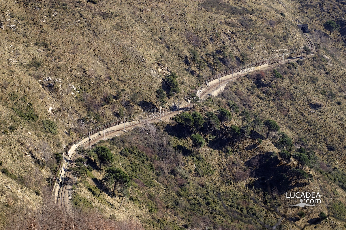
Un tratto dei binari della ferrovia Genova-Casella

Un tratto dei binari della ferrovia Genova-Casella

Un tratto dei binari della ferrovia Genova-Casella.
Qualche tempo fa ho percorso il sentiero, molto bello, che da Forte Sperone arriva fino al Forte Diamante, sulle alture di Genova.
Lungo il percorso si vedono spesosi binari della linea percorsa dal Trenino di Casella (here il sito ufficiale) che prima o poi vi prometto che vi documenterò.

Hai mai percorso la Genova-Casella? Aggiungi un comment or go to the bottom of the site to read what other visitors have written.

Un tratto dei binari della ferrovia Genova-Casella

Photo taken with Canon EOS M100 and lens Tamron 16-300.

La ferrovia Genova-Casella è una linea ferroviaria a scartamento metrico che collega il centro della città di Genova con il suo entroterra, giungendo nel paese di Casella in alta valle Scrivia. Il tracciato è lungo poco più di 24 chilometri ed effettua un percorso totalmente montano attraverso le valli Bisagno, Polcevera e Scrivia.
Continue and learn more on Wikipedia
A section of the tracks of the Genoa-Casella railway – Une section des voies du chemin de fer Gênes-Casella – Un tramo de las vías del ferrocarril Génova-Casella – Uma seção dos trilhos da ferrovia Gênova-Casella – Ein Abschnitt der Gleise der Bahnstrecke Genua-Casella – Một đoạn đường ray của tuyến đường sắt Genoa-Casella – 热那亚-卡塞拉铁路的一段轨道 – ジェノア-カセラ鉄道の線路の一部

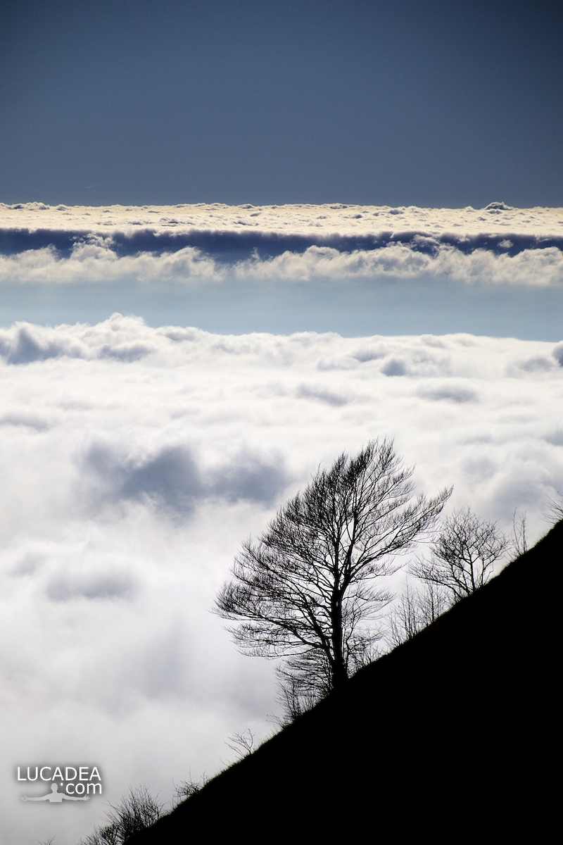
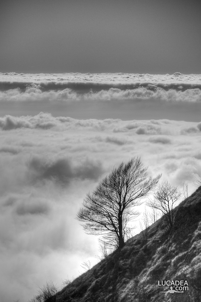
Un albero sulle nuvole dal Monte Zatta

Un albero con alle spalle un tappeto di nuvole visto dal Monte Zatta

Un albero con alle spalle un tappeto di nuvole visto dal Monte Zatta.
Diverso tempo fa ho percorso lo splendido sentiero del Monte Zatta con partenda dal Passo del Bocco.
Uno dei sentieri più belli che abbia mai percorso.
Sulla cima c’era quest’albero con alle spalle tutte queste nuvole che sembravano un tappeto!
Ho scattato due foto: a colori ed in bianco e nero.

Have you ever been on this trail? Add a comment or go to the bottom of the site to read what other visitors have written.

Photo taken with Canon EOS M100 and lens Tamron 16-300.

I took several photos along the Monte Zatta path and if you want to see them go to this page:

To see in detail the path I took I invite you to go to wikiloc.com.

The summit of the Zatta mountain massif consists of a long wavy ridge, crossed by an easy ridge path. On the outer edges of this ridge are the Zatta di Ponente mountain (1355 m) and the Prato Pinello mountain (1390 m). Between the two ends rises the main peak, the Zatta di Levante mountain (1404 m). The southern slope is steep and stony, while the northern slope, towards the Bocco pass, has a gentler slope and is covered by a large beech forest.
Continue and learn more on Wikipedia
A tree with a carpet of clouds behind it seen from Monte Zatta – Un arbre avec un tapis de nuages ​​derrière vu de Monte Zatta – Un árbol con una alfombra de nubes detrás visto desde Monte Zatta – Uma árvore com um tapete de nuvens atrás vista do Monte Zatta – Ein Baum mit einem Wolkenteppich dahinter vom Monte Zatta aus gesehen – Cây với thảm mây phía sau nhìn từ Monte Zatta – 从 Monte Zatta 看到的一棵树,背后有一层云层 – モンテザッタから見た背後に雲のカーペットがある木

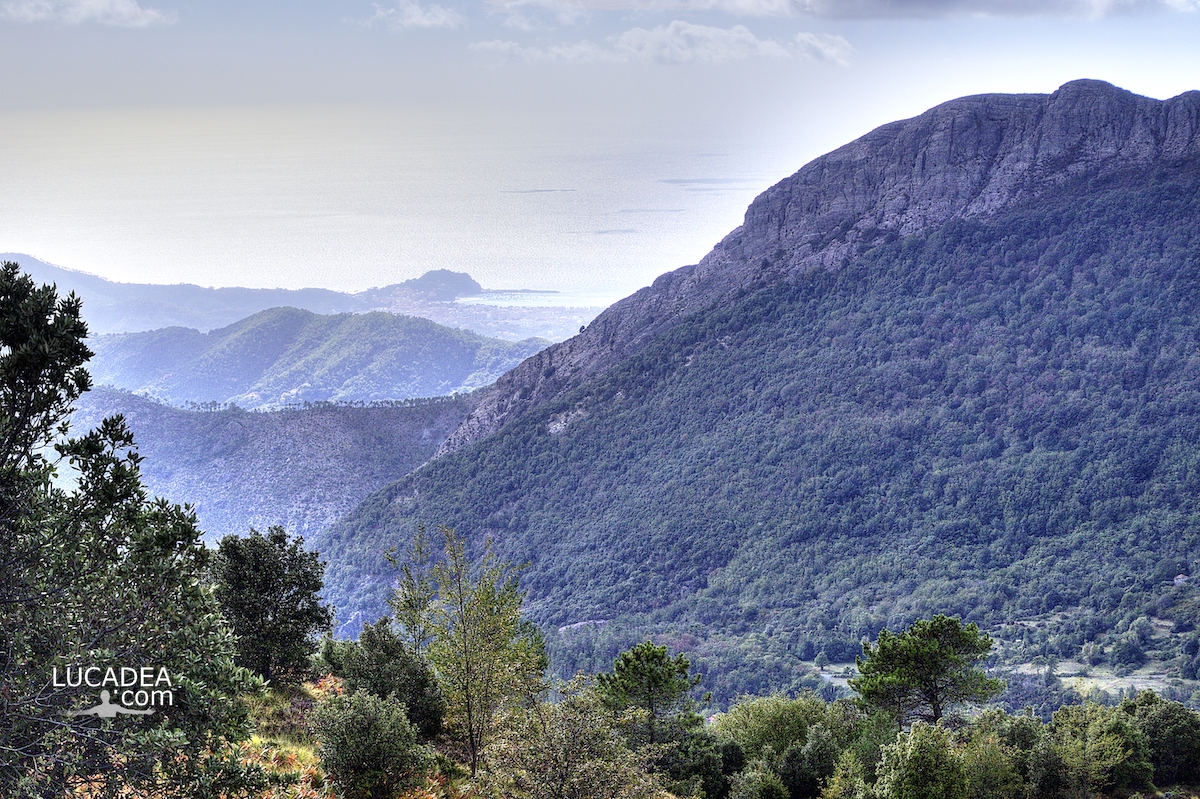
La vista sul Treggin e Sestri Levante dal sentiero del Bocco di Bargone

La vista sul Treggin e Sestri Levante dal sentiero del Bocco di Bargone

La vista sul Treggin e Sestri Levante dal sentiero del Bocco di Bargone.
Ancora una foto scattata diverso tempo fa da poco sotto al Bocco di Bargone e che fa vedere il primo piano la cresta del monte Treggin e sullo sfondo la bella Penisola di Sestri Levante.

La vista sul Treggin e Sestri Levante dal sentiero del Bocco di Bargone

Photo taken with Canon EOS M100 and lens Tamron 16-300.

Per vedere tutte le foto del sentiero clicca here:

The view on Mount Treggin and Sestri Levante from the Bocco di Bargone path – La vue sur le mont Treggin et Sestri Levante depuis le sentier Bocco di Bargone – La vista sobre el monte Treggin y Sestri Levante desde el sendero Bocco di Bargone – A vista sobre Treggin e Sestri Levante do caminho Bocco di Bargone – Der Blick auf den Monte Treggin und Sestri Levante vom Bocco di Bargone-Pfad aus – Quang cảnh Núi Treggin và Sestri Levante từ con đường Bocco di Bargone – 从 Bocco di Bargone 路径看 Treggin 和 Sestri Levante – BoccodiBargoneパスからのTregginとSestriLevanteの眺め

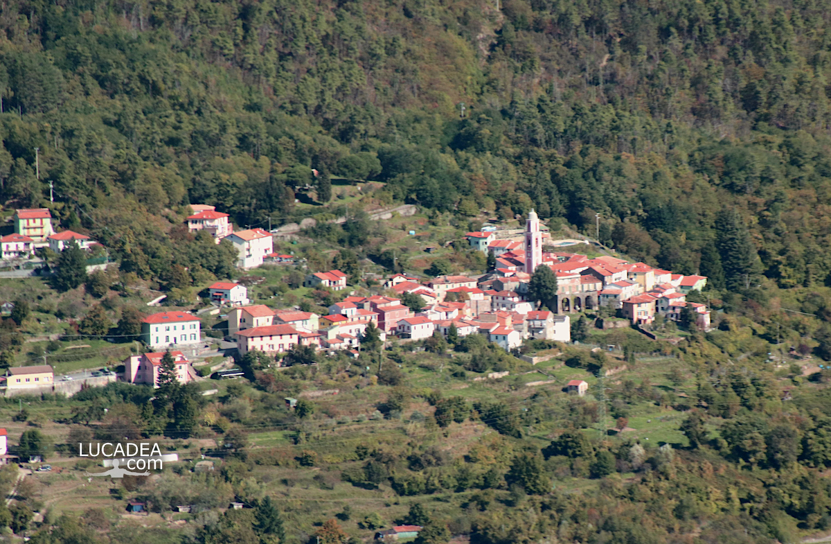
Il borgo di Castello frazione di Carro visto da lontano

Il borgo di Castello frazione di Carro visto da lontano

Il borgo di Castello frazione di Carro visto da lontano.
Mentre percorrevo il sentiero che dal monte Nicolao va al Valico Mola si apre la vista su tutta questa parte di entroterra ligure, in provincia di La Spezia.
Tra i vari paesi e borghi che si scorgono, in questo scatto vi propongo il bel borgo di Castello una frazione del poco più grande borgo di Carro.

Conosci questo borgo? Lascia un commento cliccandohere.

Il borgo di Castello frazione di Carro visto da lontano

Photo taken withCanon EOS M100 and lensTamron 16-300.

Here is where the village is located:

The village of Castello fraction of Carro seen from afar – Le village de Castello fraction de Carro vu de loin – El pueblo de Castello fracción de Carro visto desde lejos – A vila de Castello fração de Carro vista de longe – Das Dorf Castello Bruchteil von Carro aus der Ferne gesehen – Ngôi làng Castello một phần của Carro nhìn từ xa – 从远处看到的卡罗的卡斯特罗村 – 遠くから見たカロのカステッロの村

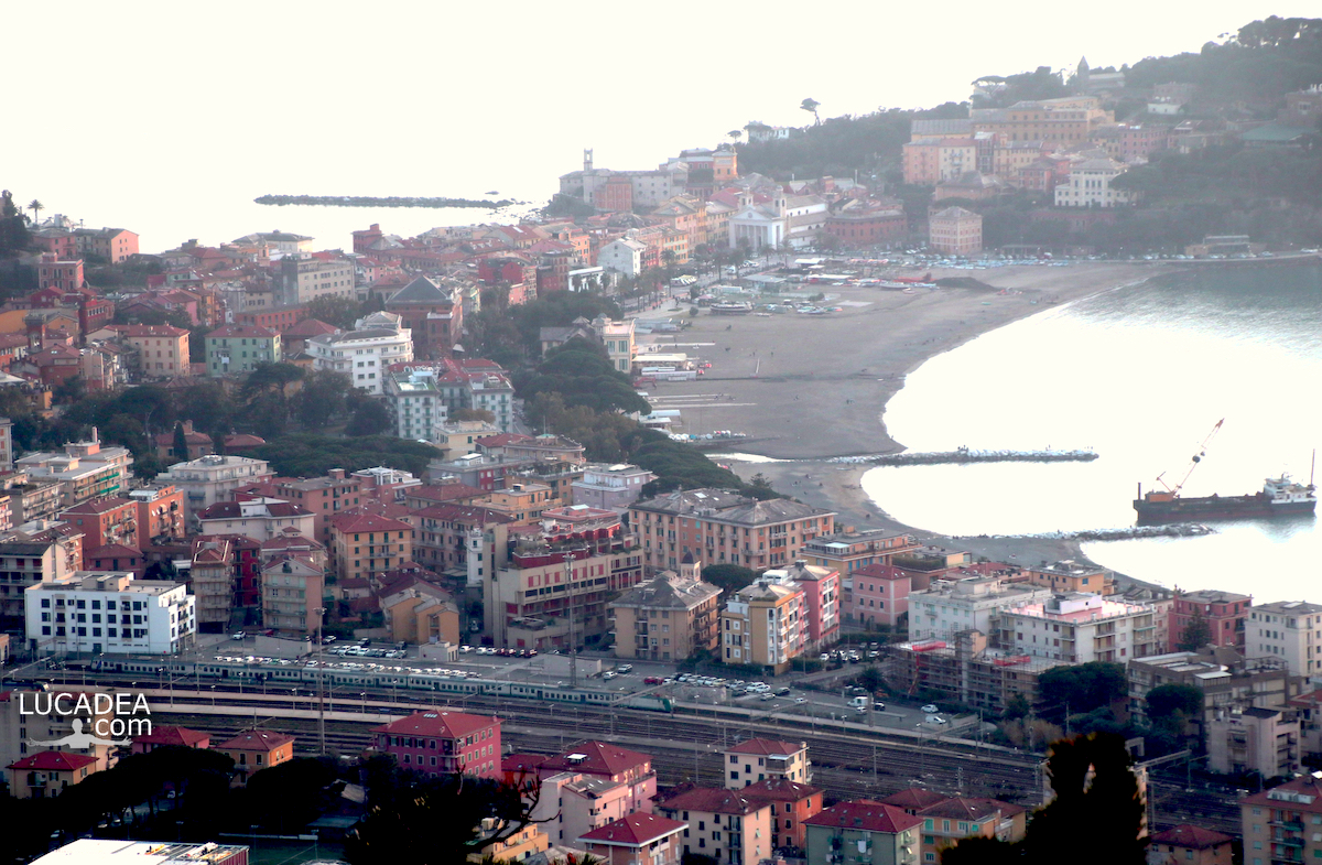
La Baia delle Favole di Sestri vista da Sant’Anna

La Baia delle Favole di Sestri Levante vista da Sant'Anna

La Baia delle Favole di Sestri Levante vista da Sant’Anna.
Salendo alle Rocche di Sant’Anna tutte le volte mi piace fotografare la mia bella Sestri e, da questa posizione, si riesce a inquadrare benissimo la Baia delle Favole anche in una giornata non molto bella climaticamente.

Do you know Sestri Levante? Add a comment or go to the bottom of the site to read what other visitors have written.

La Baia delle Favole di Sestri Levante vista da Sant'Anna

Photo taken with Canon EOS M100 and lens Tamron 16-300.

The Bay of Fables of Sestri Levante seen from Sant’Anna – La Baie des Fables de Sestri Levante vue de Sant’Anna – La Bahía de las Fábulas de Sestri Levante vista desde Sant’Anna – A Baia delle Favole em Sestri Levante vista de Sant’Anna – Die Bucht der Fabeln von Sestri Levante von Sant’Anna aus gesehen – Vịnh ngụ ngôn của Sestri Levante nhìn từ Sant’Anna – 从圣安娜看到的 Sestri Levante 的 Baia delle Favole – サンタナから見たセストリ・レバンテのバイア・デッレ・ファヴォーレ

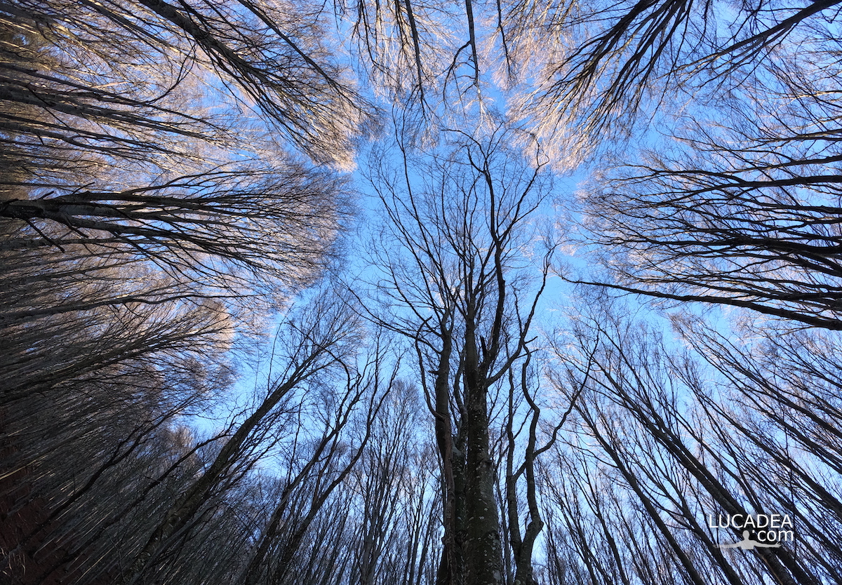
Le fronde degli alberi nella faggeta del Monte Zatta

Le fronde degli alberi nella faggeta del Monte Zatta

Le fronde degli alberi nella faggeta del Monte Zatta.
Qualche mese fa ormai (a fine novembre) sono stato sul Monte Zatta e ho percorso il sentiero da anello che parte dal Passo del Bocco.
Veramente una bella passeggiata di circa dieci chilometri (che ho percorso in cinque ore senza correre) che attraversa il bellissimo bosco quasi interamente composto da faggi. Una delle più belle faggete di Liguria.

Sei mai stato su questo sentiero? Se hai domande oppure se vuoi farmi sapere la tua opinione su questo articolo lascia un commento cliccando here.

Le fronde degli alberi nella faggeta del Monte Zatta

Photo taken with Gopro Hero 10 black.

I took several photos along the Monte Zatta path and if you want to see them go to this page:

To see in detail the path I took I invite you to go to wikiloc.com.

The summit of the Zatta mountain massif consists of a long wavy ridge, crossed by an easy ridge path. On the outer edges of this ridge are the Zatta di Ponente mountain (1355 m) and the Prato Pinello mountain (1390 m). Between the two ends rises the main peak, the Zatta di Levante mountain (1404 m). The southern slope is steep and stony, while the northern slope, towards the Bocco pass, has a gentler slope and is covered by a large beech forest.
Continue and learn more on Wikipedia
The fronds of the trees in the beech forest of Monte Zatta – Les frondes des arbres dans la forêt de hêtres de Monte Zatta – Las frondas de los árboles en el hayedo de Monte Zatta – Die Wedel der Bäume im Buchenwald des Monte Zatta – Lá cây trong rừng sồi ở Monte Zatta