The volcanic beach of Tazacorte in La Palma

La spiaggia vulcanica di Tazacorte a La Palma

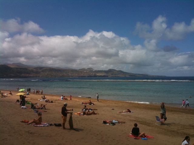
Tazacorte Volcanic Beach in La Palma.
Tazacorte Volcanic Beach is located on the island of La Palma, in the Canary Islands, and is one of the most fascinating natural attractions of the archipelago. This beach is a beautiful stretch of black sand, which extends for about 400 meters along the western coast of the island.
What makes Tazacorte Beach unique is its volcanic origin. The black sand is a direct result of the past and present volcanic activity of the island. The sand is mainly composed of basalt and lava, creating a breathtaking contrast with the deep blue of the Atlantic Ocean.
In addition to its natural beauty, the beach also offers a variety of services and activities for visitors. There are bars and restaurants along the seafront where you can enjoy local dishes and fresh seafood. In addition, you can practice a wide range of water activities, such as swimming, snorkeling and kayaking, thanks to the favorable conditions of the surrounding waters.
Tazacorte is also a popular destination for lovers of sun and tranquility. Thanks to its mild climate and sheltered location, the beach is an ideal place to relax and enjoy the breathtaking views of the surrounding mountains and ocean.
In addition, the nearby town of Tazacorte offers visitors the chance to explore traditional Canarian architecture, sample local cuisine and immerse themselves in the island's culture.
In short, the volcanic beach of Tazacorte is an unmissable stop for those visiting the island of La Palma, offering a unique experience that combines natural beauty with the island's geological history.

Do you know La Palma?
Add your own comment or go to the bottom of the site to read what other visitors have written.

Photo taken with Canon EOS RP and lens Tamron 16-300.

To see all the photos click here:
foto gallery

Where is the beach located:

The volcanic beach of Tazacorte on the island of La Palma – La plage volcanique de Tazacorte sur l’île de La Palma – La playa volcánica de Tazacorte en la isla de La Palma – A praia vulcânica de Tazacorte na ilha de La Palma – Der Vulkanstrand von Tazacorte auf der Insel La Palma – Bãi biển núi lửa Tazacorte trên đảo La Palma – 拉帕尔马岛塔萨科尔特火山海滩 – ラ・パルマ島のタサコルテの火山ビーチ

The text of the post was written with the help of ChatGPT, a language model from OpenAI.

The camels of Timanfaya on the island of Arrecife

I cammelli del Timanfaya nell'isola di Arrecife

A camel caravan in Timanfaya Park on the island of Arrecife.
Last year, I finally managed to visit Timanfaya Park on the island of Lanzarote.
The park is visited by taking a tour, in my case by bus, among the many volcanic peaks (active and not) in the area.
However, there is also the possibility of taking a tour on camels, animals that were used a lot in the past on the island, hence this camel caravan that I photographed.

Do you know the island of Arrecife?
Add your own comment or go to the bottom of the site to read what other visitors have written.

I cammelli del Timanfaya nell'isola di Arrecife

I cammelli del Timanfaya nell'isola di Arrecife

I cammelli del Timanfaya nell'isola di Arrecife

Photo taken with Canon EOS RP and lens Tamron 16-300.

To see all the photos I took in the park, click here:
foto gallery

Timanfaya National Park is a national park that extends over the southern portion of Tinajo and the northern portion of Yaiza, in Lanzarote, Spain. The park occupies a significant part of the southwestern quadrant of the island of Lanzarote.
Continue and learn more on Wikipedia

Uma caravana de camelos no parque Timanfaya, na ilha de Arrecife – Une caravane de chameaux dans le parc Timanfaya sur l’île d’Arrecife – Una caravana de camellos en el parque de Timanfaya en la isla de Arrecife – Uma caravana de camelos no parque Timanfaya, na ilha de Arrecife – Eine Kamelkarawane im Timanfaya-Park auf der Insel Arrecife – Đoàn lạc đà ở công viên Timanfaya trên đảo Arrecife – 阿雷西费岛蒂曼法亚公园的骆驼商队 – アレシフェ島のティマンファヤ公園のラクダのキャラバン

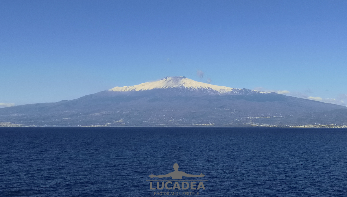
Alle falde dell’Etna

Alle falde dell'Etna

Alle falde dell’Etna.
Qualche settimana fa, con la nave, attraccavamo a Catania. A dire la verita’ non sono mai sceso a farmi un giro in citta’ ma quasi tutte le mattine, prima di arrivare, passando davanti a questo vulcano mastodontico, ancora innevato, rimanevo senza parole.

Alle falde dell'Etna

Photo taken with Honor 10.

L’Etna o Mongibello è un complesso vulcanico siciliano originatosi nel Quaternario e rappresenta il vulcano attivo terrestre più alto della placca euroasiatica. Le sue frequenti eruzioni nel corso della storia hanno modificato, a volte anche profondamente, il paesaggio circostante, arrivando più volte a minacciare le popolazioni che nei millenni si sono insediate intorno a esso.
Il 21 giugno 2013 la XXXVII sessione del Comitato UNESCO, ha inserito il Monte Etna nell’elenco dei beni costituenti il Patrimonio dell’umanità.
Continue and learn more on Wikipedia.

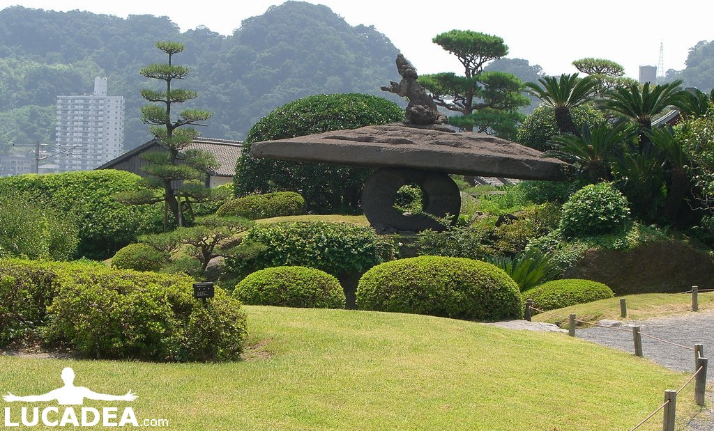
Foto di Kagoshima in Giappone

kagoshima

Foto di Kagoshima in Giappone.
Eccovi una delle foto di Kagoshima in Giappone, scattate diverso tempo fa dall’amico Checco.
Kagoshima è un’isola vulcanica giapponese a pochi chilometri dal vulcano attivo Sakurajima.
Detta anche la “Napoli del Giappone” per la somiglianza (paesaggistica) con la città partenopea. Le due città hanno infatti anche un gemellaggio.

kagoshima

Se vuoi sapere di più sulla città vi rimando a Wikipedia, come sempre.

Click here to see all the photos.
foto gallery

Photo of Kagoshima in Japan / Foto von Kagoshima in Japan / Ảnh về Kagoshima ở Nhật Bản